Monday, March 28, 2011

Goodwill Conservation Area 3/26/11

"Mossicles" (pictures)

Directions: Barrington, NH head West on Rt. 9 past Calef's Country Store and the Pine Grove Cemetery. You will pass Province Rd. on the left and on the corner to the left is the pine tree hidden entrance to the parking area. The sign is set back from the road and you will see the marsh.


Yet another cold, windy weekend was really getting on our nerves! The forecast for below average temperatures hovering around 30 with strong winds had us bummed out Friday night. So we decided on just waking up whenever and hiking something small and close by. We headed out in the morning, winter jackets in hand...blah! I was undecided on heading to nearby Blue Job Mt., Little Niagra Falls or Stonehouse Pond. Instead I set my sights on something I visited back in October 2010, Goodwill Conservation Area. Scott had not yet been here and it was raining last I visited. It was an easy logging road walk and sheltered somewhat from the winds. So this was a good  choice!

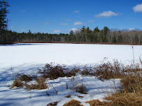
The parking lot was still partially plowed in, but nothing four-wheel-drive couldn't handle! We threw our jackets on already cold just from stepping out of the truck! The time was 11am. The marsh was still frozen over as we made our way over the small bridge over the outlet stream. Then right at the fork to follow the trail along the marsh. The trail makes a small loop, but Scott noticed a barely visible trail at the loops corner that continues to follow the marsh! This trail basically follows the bank along the shore of the marsh until it joins the main logging road (left at the before mentioned fork).

From here we followed the road beyond the marsh and slightly uphill past some small quarry sites. A lone track of fresh footprints were noticed in the snow patches in one direction. We were apparently not along in these woods! Sure enough a man came into view headed back out. He looked surprised to see anyone here and was happy to tell us the logging road goes all the way over to Beauty Hill Rd. We soon reached the ledges rising on either side of us sporting green moss, lichen and melting ice. It was very pretty. You can take a left before the ledge and follow a trail that breaks left to an open area with a tree top view across the valley. Back on the ledge a fire pit was left with a broken liquor bottle and beer cans. Once again I should have brought a trash bag with me. It's just so upsetting to always have to take a trash bag with you to pick up after those who don't respect nature and the law for that matter!

 We now followed the mans tracks trying to figure out which direction he went. Scott took off hot on his trail as I slacked behind still at the ledge taking pictures of icicles poking out from the moss which I call "Mossicles" :p>LOL! I caught up and we walked the road which made a loop to another part of the marsh where we explored the woods and shore in this area. Then the road loops back to the ledge again. Perfect! We now made our way back towards the parking lot making note of some of the pretty rocks laying around near the quarry areas. We finished  this fine figure eight loop at 12pm. An hour well spent! This is a family friendly walk, easy for all ages! Views are not what this area boasts of. But the marsh, forest and ledges are pretty and in the summer your sure to see a wood chuck, otter or beaver!

Tuesday, March 22, 2011

Presque Isle State Park 5/29/10

"A Great Lake!" (pictures) http://www.dcnr.state.pa.us/stateparks/parks/presqueisle.aspx

Again, something I never got around to reporting on until now. This was a vacation in Pennsylvania. With plans to possibly re-visit this aea I figured I would get this up on my blog! I was very excited to visit this area and it did not dissapoint!


We made our way down the long road that follows the shore of the Pennynsula that reaches into Lake Erie. I had always wanted to see a Great Lake! The side of the road and grass was covered in white! It almost looked like snow! Turned out to be cotton trees, how awesome!


We parked in the empty parking lot, again having the park pretty much to ourselves as with Pymatuning! The trail we took was Gull Point which brings you to the gull nesting area.


Along the way we saw beautiful tall grass,


turtles,


birds at the Gull Point Natural Area where there is a small viewing platform.


And beaches with beautiful, smooth, little stones along the shoreline.


Yet another perfect day! Beautiful weather and so quite! As we arrived back at the car there was a Massachusettes car parking next to us, "hey neighbors!" We continued down the road making a stop for a short walk to a lighthouse. I can't wait to return here and walk the extensive inland trail system!


Then it was off to the Tom Ridge Environmental Center at the entrance to the park.This contained exhibits, an eatery and gift store. And a wonderful tower view of the park.

Pymatuning Lake State Park 5/27-30/10

"A Wonderful Little Hide-away" (pictures) http://www.dcnr.state.pa.us/stateparks/parks/pymatuning.aspx

Something I never got around to reporting on until now. This was a vacation in Pennsylvania. With plans to possibly re-visit this aea I figured I would get this up on my blog! I found this area on the Western border of Pennsylvania and Ohio. While the Southern end of the lake is more a boat launch/tourist area the Northern part is more wild and quite. We were lucky to have this place mostly to ourselves!

The park is in Titusville and off the road there is a lake side deck where you can feed the thousands of hatchery fish.


Canadian Geese are also here by the hundreds!


There is a trail also that makes a small loop through a forested area and along the shore of the lake. The interprative trail identified the trees and birds of the area. Our favorite was the Black Oak!


We also got to see a Bald Eagle pointed out to some bird watchers. And many, many other birds.


We spent most our early mornings there and also caught a beautiful sunset! What a wonderful, unique little spot!

Monday, March 21, 2011

Ticks and Bears and BOBCATS, oh my!

An increase in the Bobcat population has spawned a study by the NH Fish and Game. Bobcats became a protected species in 1989. Check out these two links for information and pictures on Bobcats and the study being done.

You can also report sightings on the NH Fish and Game site. Keep your eyes open for the big, beautiful cats! Here's 2 pictures I took this past February of what I believe may have been a bobcat imprint!

http://mlitvaitis.unh.edu/Research/BobcatWeb/bobcats.htm
http://www.wmur.com/news/27262549/detail.html

William H. Champlin Jr. Forest Preserve 3/20/11

"A Late Day Jaunt" (pictures)

Plans for hiking on Saturday ensued during the week as always and the weather was looking pretty good. Laurie and Russ were hitting Mt. Carrigain with some friends and invited us along. Not really up for a long 4000 footer hike, especially on snow shoes we passed up o it. (Too bad too, they turned out to have a great day and got to see a Black Hawk Helicopter hover over Signal Ridge!!) I went to bed Friday night not knowing what we would be hiking in the morning but confident it would be a nice day. Well the morning proved to be cold and it was blowing a mix of snow and rain on us. YUCK! We moped around a bit, just enough to not want to hike anymore! I had a house rental that needed to be cleaned anyway so we decided to get all our work done and try for Sunday. Well Sunday morning was again cold...clear, but cold. And we just were NOT in the mood! So, after some walking around in Lowe's I headed off to get the rest of my work done.

The end of winter was turning out to be a bummer-of-a-weekend! I finished my work late in the day and called Scott. At the end of our conversation Scott mentioned we should meet in Gonic for a short walk. Funny, I was thinking this earlier! So we planned on meeting instead at the SPNHF William H. Champlin Forest Preserve across from the Sky Haven Airport in Rochester. I arrived in the parking lot ahead of Scott and decided to pick up some of the trash. I did this in the summer and was glad to see it hadn't gotten too bad since. Aside from a large suitcase sitting out in the field....are freakin' kidding me!? Scott pulled up and we headed down the trail at 6:20pm, the sun beginning to touch the tree line. Through the wet field, I stopped to take some pics of the Milk Thistle Pods.

The logging roads to the lower marsh were intermittent with snow and standing water. We went as quickly as we could without getting wet! At the pine grove just before the marsh I noticed a dozen or more bullet shell casings in the snow with the letter 'F' marking. We arrived at the marsh at 6:38pm just as the sun was setting. Perfect! A few pictures, most of which didn't come out all that great and it was back to the vehicles before it got dark! We got back to the field, picked up a stinky "doggy bag" and plastic bottle and headed out just as it was getting dark at 7pm. A nice brisk walk to end the weekend! And the best part, "hiking" equals Chinese Food and a Coke N' Rum! :) HAPPY SPRING!!

Friday, March 18, 2011

Northwood Meadows State Park 3/17/11

"Loop and Lunch" (pictures)

I was scheduled to have my monthly lunch with my Gram in Epsom on Thursday. I generally do a quick hike around Stonehouse Pond afterward but I wanted to try something else this time. So I decided to get up early and head to Northwood Meadows in ... you guessed it, Northwood! I printed off a map from the NH Parks & Recreation site and headed out! Onto Rt. 4, also known as Antique Alley and a large sign marks the parking area. It's pretty impressive the number of State Parks and Wildlife/Forests areas in this part of the state!

I parked next to two cars, threw my back pack on with some light winter/emergency gear in it and headed off down the logging road at 10:30am. This large logging road (a snow mobile trail in winter) was nice and packed for bare booting. Dog shit was all over the place which never fails to piss me off! Pick up after your dog! It's the law and it's gross! After crossing the river you can continue on the road or there are two trails (smaller logging roads) that break off to the right. These are marked with a "no snow mobiles" sign. I passed the first and decided to take the second. Brush and a black erosion barrier lines most of the trail along the small stream.

After negotiating some ice the trail opens up as you come back out onto a large logging road known as the NALMC Trail. There is a nice view across the lake, still frozen with snow and ice. I continued on counter clockwise taking the first trail which makes the pond loop. The trail follows the pond and passes a peninsula of sorts with a picnic area. I took some pics, picked up a beer bottle and kept my quicker-than-usual-so-I-am-not-late-for-lunch pace!

I broke back off of the logging road at the Southern most part of the pond crossing a dam. I negotiated some more ice as the trail swings South for a view across the large marsh, then cuts back North again. The trail climbs the banking away from the ponds edge for a little bit then follows it closely again. I stopped to take pictures at one spot and looked down at a beaver stump to find some fine Slime Mold specimens! And as most know, a fungus photo opportunity makes me a happy person!

I crossed a small stream, the bridge marked with a blue broom! What a unique trail blaze, LOL! I took some pics here of the rushing stream. Checked my phone to see I was running late and got a move-on! I passed another picnic area near a rocky shore and scored my favorite pond picture of the day. I then connected back on to the main logging road passing a kiosk and outhouse. As I neared the parking area people were coming down the trail by the handful. All with dogs. Apparently a very popular dog walking area. I finished this lovely pond loop at 11:45am and got to lunch right on time! :-)

Monday, March 14, 2011

Man transported down Washington's Ammo Trail

A man suffering a possible heart attack was transported down Mt. Washingtons Ammonusuc Trail on Saturday 3/12/11. View all hiker related incidences in NH on the lower right column of this page >
http://www.wildlife.state.nh.us/Newsroom/News_2011/News_2011_Q1/SR_Ammonoosuc_Ravine_031211.html

The Rattlesnakes 3/12/11

"Small Mountains, Huge View!" (pictures)

Our hike up Mt. Major with Laurie, Russ and Marcus cancelled last weekend due to rain, we met for lunch in Concord instead. Before heading our separate ways we decided to try again the following weekend and set our sights on Mt. Cardigan. Friday came along and the weather was looking bad again, rain! Sure enough Laurie saw the same and we decided to scrap the hike again. Bummed out I kept an open mind for Saturday and Scott too thought we should try for something and see how the weather turns out. I had the feeling we would have a half decent day if we stayed away from the North Country.

Along came the morning, cool, sunny and dry! I headed North through Meredith for Squam Lake. I had been wanting to try something along the Northern fringe of Squam Lake for some time now. Percival was the destination, the Rattlesnake's in the back of my mind as a back up. As we came closer to Rt. 113 I began to notice signs for "No Northern Passage, LiveFreeOrFry.org". It was rather humorous, on the other side of the lake are signs for "Free Ward Bird". Us Northern'ers don't mess around! And for the record, I say NO to the Northern Passage! Clouds were thicker the further North we went but I kept my hopes up that they would break! We past the Rattlesnake/Morgan parking lots and found the Percival lot not plowed in the winter. So back to the Morgan parking lot we went. One other car was in the parking lot.

We began our hike at 9:13am on the Mt. Morgan Trail. We did not bring our snow shoes or winter jackets, why? Well, we weren't looking to get all that into a big hike today and frankly we are ready for Spring! The trail was well packed but getting a little soft in places. The wind was blowing a cold breeze at us and by the time we reached the Morse trail to cut over to Mt. Percival trail I wasn't feeling good about this hike. Based on conditions and our lack of winter jackets there was a slim chance of us getting all that far on a 2200 foot mountain!

So I made the decision to head back and across the street to do the Rattlesnakes. This was OK as I have been wanting to check these out anyway. The Old Bridle Path trail for the West peak almost immediately begins to climb moderately. We were slow for much of the climb. Neither of us were feeling very energetic today. So we just took our time and enjoyed the cool fresh air. As the trail leveled off we got a little more energy about us. Just then an owl swooped across the trail and landed in the trees ahead. An owl sighting is rare and always exciting! I was able to spot him through the trees and was excited that I could get a picture of him watching us. No sooner did I get the pic, he took off out of sight.

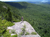
We now began to see wooded ledges to our right and then a spur trail breaks right to a small ledge. The sun was beginning to break through the clouds lending a warming touch to the brisk air. Soon there after the main trail comes out onto a fabulous ledge. All I could say was WOW! The spectacular 180 degree view wraps around from Red Hill to the left, across Squam & Winnipesaukee Lakes and their surrounding mountains and part of the Squam Range. The time was 10am. We took a bunch of pics here and on the rock outcrops. There is also a survey marker here too. The cold wind chilling us down I talked Scott into heading to the East peak.

There is a large sign here at the ledge marked as the Armstrong Natural Area. Past this, now on the Ridge trail you pass a very interesting rock formation on the left. It is triangular shaped and sliced perfectly leaving a cross section of puzzle like cracked stone in the center. As you traverse the small ridge you cross at or near the West summit peak (1260'). Then you descend down to a col. and climb again to another ledge. This ledge smaller and a more limited view looks directly over to the massive presence of Fire Tower topped Redhill and it's long ridge marked on it's North end by Eagle Cliff. You can also see the even more massive Northern section of the Shaw/Ossippee Range beyond Redhill's ridge. We then made the short walk up to the summit of East peak (1289') for about 10:45am.

Back at the ledge for a quick bite then it was back down to the col. and back up to the West peak ledge. As we climbed back up I couldn't help but notice the immense growth of lichen on the trees. I first noticed this on a few trees which had a white bark that was crackled and had reddish splotches. I don't recall seeing this type of tree before. The lichen and moss were growing all over these and other trees clinging to the small cracks in the bark. I began to think about just how many enemies tree's have going against them! Lichen, moss, wind, ice, wood peckers, termites, erosion, fire, humans and that's just the obvious ones! And yet they survive!

One more stop at the ledge, then we began the climb down. We passed a family of four heading up and nearer the bottom passed two sister's whom we had a pleasant conversation with. It sounded as though they were beginners to hiking. They mentioned doing Mt. Willey via. "the ladders" and said it killed them but was in awe at the summit ledge and with the Gray Jays greeting them! Having just done this hike this past summer we new all too well the difficulty of that trail and the beauty at the summit ledge. They had snow shoes on order and were hiking the Rattlesnakes regularly to get in shape for some more 4k hiking in the summer.

We quickly reached the parking lot from here to find this lot half full and the Morgan lot full! There were 5 Rhode Island plates and a Texas plate. Odd, perhaps all visiting the area together?? We finished this wonderful hike around 12:00pm. Highly recommended, a great short family hike! 3.4 miles for the day, 1000 feet elevation gain.

Sunday, March 13, 2011

Ice Climber Falls 1300 Feet!

An ice climber fell 1300 feet from Huntington Ravine on Mt. Washington Thursday. He was alone on the climb and was climbing back down due to unstable conditions. This triggered an avalanche which carried him down the gully. Dispite this and serious injuries he was able to call 911 for help.

Signs are clearly posted at each of Washington's ravines (Tuckerman's & Huntington) and the days conditions were posted as "cosiderable danger". climbers and hikers alike should take warnings into consideration and sould be very alert to conditions on any ravine or steep sided mountain at this time of year.

News Report> http://www.wmur.com/news/27161433/detail.html

Thursday, March 10, 2011

Invasive Pests First Detector's Training 4/7/11

Invasive Pests First Detector's Training
April 7, 2011
8:30 am to 3:00 pm
at the Susan N. McLane Audubon Center, Concord.

The 'first-line of defense against invasive and introduced pests and diseases...we need you!'

Learn how to identify invasive insects, plants and pathogen threats to our forests and crops. Learn how to collect and submit specimens for identification. Become a member of a national network of First Detectors.
 
http://us1.campaign-archive1.com/?u=19c1439008b7d704028a205a8&id=861ae5741f&e=487f08d8a0

Saturday, March 5, 2011

$ Bicycle Items For Sale $

A friend is selling these, e-mail me if interested> hikethesummits@yahoo.com

Indoor Bicycle Trainer $60 SOLD!

Bicycle Handle Bar Lights $60

Friday, March 4, 2011

Man blown off Katahdin's ridge, spends the night lost! (2/20/11)

YIKES! Not a mountain I would want to be blown off of or spend a cold night on! He is very lucky to have survived! I wonder if it was near or on the knife edge? The news REPORT


Mt. Katahdin is a very beautiful mountain range in Baxter State Park, ME. I have only been there once and I am so anxious to return. It is a very long day hike and the entry into the park is strickly limited and controlled. As annoying as this is, it makes for a very unique experience where overcrowding is completely mininmized!

Mt. Katahdin boasts of very narrow, steep, completely exposed ridges including the aptly named "knife edge". And a deep fischer that you must climb down and again using hand-holds then climbs to a spire called the "chimney". It is the Northern most point of the Appalachian Mountain Trail and the highest mountain in Maine.

Wednesday, March 2, 2011

D Acres Snow Shoeing (Dorchester, NH)

Dorchester, NH: Join D Acres Farm and Homestead on a guided tour of it's trails 1-4pm every Sunday!

Tuesday, March 1, 2011

Weeks Act turns 100!

Why should you care about the Weeks Act? What does it have to do with hiking? Well, this law was created to allow the Federal Government to purchase land to protect water sheds/streams and the ability to navigate through them. This was already being done in the West but the Eastern forests were being clear cut causing erosion, fires and the rivers to alter their course. On March 1, 1911 Congressman John W. Weeks, born in Lancaster, NH helped to make this bill pass. The bill set aside $9 million to purchase 6 million acres East of the Mississippi. Later on the law would be altered to include non-watershed land such as forests and mountains and was made even easier for private land to be purchased.

This law allowed the formation of many National Forest's including the White Mountain National Forest, Green Mountain National Forest, Pisgah National Forest, George Washington National Forest, and Ottawa National Forest.


Much has changed, forests have grown back, river's are healthy and flowing freely, animals have re-inhabited the forest's and people are able to enjoy the serenity that comes from vast, unaltered and un-touched forest land. Controlled tree cutting, quarrying, mills, tourism/economic growth, camping, hiking, walking, fishing, bicycling, skiing, snow mobiling, and so on are all enjoyed in sync. And so we give thanks to John Weeks and all those who had a part in this endeavor. And to those who continue to carry the torch to ensure these lands stay protected for all time! Thank you! Happy 100th :)