Monday, April 25, 2011

Ellis R. Hatch Wildlife Management Area 4/24/11

"Yet Another Woods Road" (pictures)

Difficulty: Easy (gravel/dirt road)

Directions: From North Main Street in Farmington, NH take 153 North. Continue onto Kings Highway in Middleton and follow for 4 miles. Entrance road sign is on the right set back. Follow road for a short distance to the gated trail head and sign.

Report: After spending the morning at the Moose Mountains Reservation we decided to look around for other trail heads in the area. I was trying to find Jones Road so we could walk the Horn Brook trail but somehow missed it. So I got back onto Kings Highway and looked for other signs of a trail. Shortly I spotted a sign in the woods for Ellin R. Hatch WMA. I backed up and drove down the short road to the gate. We walked a gravel and dirt road for approximately a mile passing a marsh and taking a right at a road junction and followed the road 100 feet to a kiosk and what appeared to be a half dried up pond. Upon looking on my Flickr satellite map I could see that it was once a large pond. Google map has there's updated as it is now. If you check this out it is the marsh area that is shaped like a tall boot. Not sure if a dam was removed or what happened to cause the water to recede so much but it looks to have been that way a while. Not sure where the road continued to and the weather changing from warm and sunny to cool and windy, we decided to call it a day and head home. Total time 30 minutes.

Moose Mountain Reservation & Phoebes Nable Mt. 4/24/11

"An Introduction to Moose Mountain Reservation" (pictures)

Difficulty: Easy - Moderate (steep/loose/rocky up Phoebes Nable Mt.)

Directions: From downtown Farmington, NH take Rt. 153 North into Middleton about 5 miles. Continue onto King's Highway for .9 miles. Turn right at the police station onto Ridge Road. At 1.6 miles turn left onto New Portsmouth Road. Bear left onto New Portsmouth Road Exd. The trail head and kiosk will be seen ahead. You can park at the kiosk or continue 400 feet on an unmaintained road to an upper parking area just past the river.

Report: Scott and I are set to go on Land Steward training with the NH Forest Society in May. We had chosen Moose Mountains as the area we would be responsible for. We wanted to get somewhat acquainted with this vast 2, 325 acre area before our class but had no idea as to any trail head whereabouts. Scott did some online searches during the week and found all the information we needed including a basic MAP. And so we planned our visit to the Moose Mountain Reservation for the weekend.

Unfortunately the weather called for rain showers on Saturday and Sunday was not looking the greatest. Saturday Mother Nature figured she hadn't had enough of tormenting us and threw snow showers at us accumulating to an inch! So as we got our weekend work done today we hoped for a half decent day Easter Sunday. The morning rolled around and the sun was shining and it was already warm outside! This had us excited and awake, ready to take advantage of the nice weather! Since we had no concrete knowledge of what to expect we simply planned on checking out the kiosk at the end of New Portsmouth Road and check out some of the woods roads and the old Burrows Farm site.

We found the kiosk no problem and parked here. At 8:45am we headed down the road which wasn't gated at the time following ATV tracks. Black flies were already buzzing but not yet swarming or biting. We soon came to a river and found a truck in an upper parking area. We continued on uphill past another road on the left which crosses the river again. Past this a little ways the road bears left. A trail leaves right here on North Trail. Continuing on the road you climb to a field and the Burrows cemetery under some pine trees. Just a handful of stones, with age-at-death sadly averaging in the 40's. ATV or 4x4 tracks were all through the field along with beer cans which were also along the roads. Another sad reminder that not everyone respects the land they are out enjoying.

Continuing uphill on the road you pass a trail visible at the tree line which we passed by and up to the next road junction. Here we passed a pair of hikers with a dog. They looked shocked to see us other hikers here and we said our quick hello's. Keeping straight and bearing left at this junction you pass the Burrow's Farm site on the left, now a birch and blueberry glade. We followed the road until it began do descend, then we decided to turn back and head back to the previous road junction to climb Phoebes Nable Mountain.

Climbing got steep and ruff in spots. The wet conditions from melting snow making the climb up slippery rock a little more difficult. Soon at 10:00am we reached the ledgy summit, overgrown and not revealing too much of a view. But a nice spot just the same! Notable mountains in view through the trees were Blue Job and Hussey Mts. in Farmington and Prospect Mt. in Alton, all with radio towers barely visible.

We descended back down to the field and cemetery and headed down another road past the larger Stevens Cemetery visible from the Burrows Cemetery. This road then connects back to the main road we began on. We called it a day here and decided to look for other trail heads around the area. We got back to the truck at 10:45am or so and headed out.

Friday, April 22, 2011

Happy 2011 Earth Day!

Poem "The Mountains are Calling" 


Something is calling me as I toil through my day,
The Mountains, it is they that are calling,
They beckon my restless, dryed-up soul,
Come hither, do they plead, let us rouse you senses,
Enter our sprawling forests, listen for the song of birds,
Let oneself be drawn into the deep ravines full of enchanted life,
Climb the towering ridges and majestic windswept peaks,
Taste the moist air as eerie fog passes through you like a lost spirit,
Lay and rest upon the cold slabs of broken, scoured rock,
Bask in the warming sun as the breeze blows across your tingling skin,
Release all care and anxiety upwards to the endless sky of blue,
Now as you gaze out over the valleys and peaks to the horizon,
Understand the grandeur that surrounds you,
Acknowledge your small, remarkable existence,
Forget the past, worry not of the future, meditate on what is,
Here do you come to heal your sunken spirit and restless soul,
It is here, here in the mountains that you find peace and tranquility,
A land that inspires and humbles, is rugged yet beautiful, changing and unchanged,
It has sunken into my very soul, calling out as it were, anticipating my joyful return!

By Jason S. Morris

Monday, April 18, 2011

Mt. Blue Job 4/17/11

"Sunset" (pictures)

Difficulty: Easy - Moderate:
Fire Wardens trail on South and East side of the mountain is steep and wet with loose footing.
Loop trail which follows part of the access rd. is moderate but easy footing.
Gray Hill or Little Baldy Knob trail is easy with some easy rock scrambles.

Directions: From Rt. 11/N Main St. in Rochester, NH take Rt. 202A. Just past the "4 Corner Store" take your first right at a corner onto First Crown Point Rd. Follow it for approximately 5 miles. The parking lot is on the right (signed) just over the hill. 

Report: A forth hike to end the week. We had enough of work Sunday afternoon and I figured I would go back out later after the Apprentice to finish up. We wanted to get back out and enjoy the little bit of sunshine we were getting again. We changed into our hiking boots at home and headed for Blue Job. Scott hadn't been here in a while and it had been a couple months for me. We parked and headed up the loop trail counter clockwise. I figured it would be nice to hit the fire tower then head down to the knob after.

The trail was very wet as it usually is this time of year. The setting sun was shining it's orange glow on the red budding tree's making them look on fire. The breeze was blowing at the summit but it really wasn't all that cold. We hanged out here for a few before heading down to the Little Baldy Knob. I fell behind as I stopped to take pictures at the pond and of the other surroundings. I met back up with Scott at the Baldy summit. It was a beautiful evening. It began to cool down quick as the sun dropped to the horizon. We made our way out before dark, back on a wet trail. A lovely hike indeed! I've always wanted to do a sunset hike and plan to definitely do that again!

Sunday, April 17, 2011

Knight's Pond Conservation Area 4/16/11

"The Out House Still Stands!" (pictures)

Difficulty: Easy (access road and well maintained trails)

Directions: Heading North on Rt.28 in Alton, take a right onto Rines Road. The road will change to dirt, keep left at a fork. At the top of the hill is the road on the left. A small parking area is on the right for when the road is gated.

Report: The weather being "iffy" again for Saturday we decided to hit some small hikes and play out the day as it went. The plan was to head to Castle in the Clouds to view the water falls, then hit a couple other small forests/conservation areas. As we were coming close to Wolfeboro on Rt. 28 Scott mentioned checking out a place where he used to live with his sister. He said there was a farmhouse that had since burned and a big pond down a ways from the road. Now Scott hadn't been here for about 25 years and there was no telling what happened to the property. Probably a housing development or something! Well, we arrived at the now gated road with a sign reading "Knight's Pond Conservation Area". Scott was shocked, I was excited! Another pond and forest saved....YAY!!

Cold and damp we threw long sleeve shirts and wind breakers on. As we walked the dirt road it was neat to be told what the property used to look like. "There was a big farmhouse and lawn here where this birch glade is", "a garden down the hill where that chain link fence is", "there was a cow pasture up there and a pig pin here where this wire is". And, "the out house is still standing! We used to have to walk across the lawn and road to go to the bathroom!" Too funny! I remember him telling me a story about running into a moose in the dead of night while making his way to the bathroom, LOL! We continued on down the road as it descended to a small summer time parking area and a kiosk. Then the road continued to descend until it reaches the shore of the pond. Before this there is a trail sign pointing to the left.

The trail enters the woods and then brings you along the South shore of Knight's Pond following it clockwise. A Wood Duck took flight at one point and I was disappointed that it flew to the far shore. But excited to see that they are at this pond! I'll be sure to return to try and get some pics of them! Beaver activity is seen all over. Trees chewed up all along the trail and water. The trail climbs up the banking then begins to follow the marsh at the West side of the pond. Then it crosses at a beaver dam. Such a beautiful spot! We continued on the trail following the North side of this long marsh. Scott spotted a male and female Mallard in the water and I was able to snap some photo's of them!

As we continued on, rocks and boulders became prevalent as we entered a wonderful boulder field. We stopped and took a break at the largest boulder. Here there is a trail that leaves on the right and loops around the peninsula that separates the pond and the marsh. This is an easy must do and adds about 500 feet to the trip. Winds were whipping across the water here and making it very cold. This cold, windy and damp weather has to stop! There is a good view from this trail across the marsh and down to the several beaver homes. Once the loop was made and back on the main trail we continued along the East shore noting some side trails. One that cuts back across the boulder field that we must have missed somewhere. And another that went North.

Continuing along we passed some more boulders until reaching the road again at a small beach, where Scott said they would swim at. Ending the trip was a mile long road hike uphill! All told, about 4 miles. We couldn't stop talking about what a beautiful area this was and how happy we were that it was saved and conserved for wildlife! It's by far the largest undeveloped pond I have been at and love the natural state it is in. Quite, full of wildlife and just plane beautiful! A large pond, marsh and boulder field. What more can you ask for!! A plaque at the end of the road at the shore lists the Organizations and people responsible for making Knight's Pond a conservation area in 1990. Thank you to all!!

Mt. Major 4/15/11

"A Slow Spring" (pictures)

Difficulty: Moderate (steep and rough especially on ledges)

Directions: From Alton, NH take Rt. 11 West and follow it for about 6 miles. Trail head parking lot is on the left (blue sign)

Report: It was planned early in the week to meet up with a fellow photographer for a Friday Mt. Major hike. We had previously hiked Stonehouse Pond and Jeff had not been up Major before. We hit the trail at 8:30am up the Mt. Major Trail. It was cool but otherwise nice. The trail on it's upper sections and especially just below the ledges was still holding patches of packed snow and ice. Spring is making a slow go in NH this year, that's for sure!

After passing Art (a Major regular) we reached the summit and took some pics and a small snack break. Moosilauke and Washington was in white and the other various peaks visible. The lake was still in the process of thawing. The view from here is always so incredible! Soon we were headed down via the boulder trail. The steep decent down the ledgy area was slow going then it was an easy hike out the rest of the way.

Friday, April 15, 2011

Grey Hill Road 4/14/11

"Wandering Around in the Woods" (pictures)

I nice day we decided to get out for a small hike when Scott got home from work. We were gonna head to Stonehouse Pond then decided for Blue Job Mt. But I didn't really want to make the drive so instead I headed down Meaderboro Rd. to Oxbow Pond. There is a logging road just past the pond that I believe climbs the "Little Baldy" Knob of Blue Job. I parked at the end of the road at 3:30pm. We walked down past a property site for sale which is littered with junk. Carpet, TV's, tires and other stuff dumped there.

We got to Berry's river and had to walk up stream a little ways to find a crossing. The water was flowing good and was very pretty as it hurriedly cascaded over the rocks. We crossed and headed back down stream to re-join the road. Sections were overgrown and flooded but otherwise fairly easy to follow. We also noticed footprints and dog prints in the patches of snow, so somebody was out here. It continued following the marsh and pond from a distance until we decided to call it a day due to the time.

We headed back through the woods away from the road. Bushwhacking through open forest we found an old quarry site and Scott found a large woodpecker hole up in a pine tree. Soon we came back to the river right at the point we crossed. We walked upstream a little more before crossing and headeding back out for a quick dinner and off to work!

Monday, April 11, 2011

NH Farm Museum and Mt. Teneriffe Preserve 4/9/11

"A Laid Back Day in Milton"
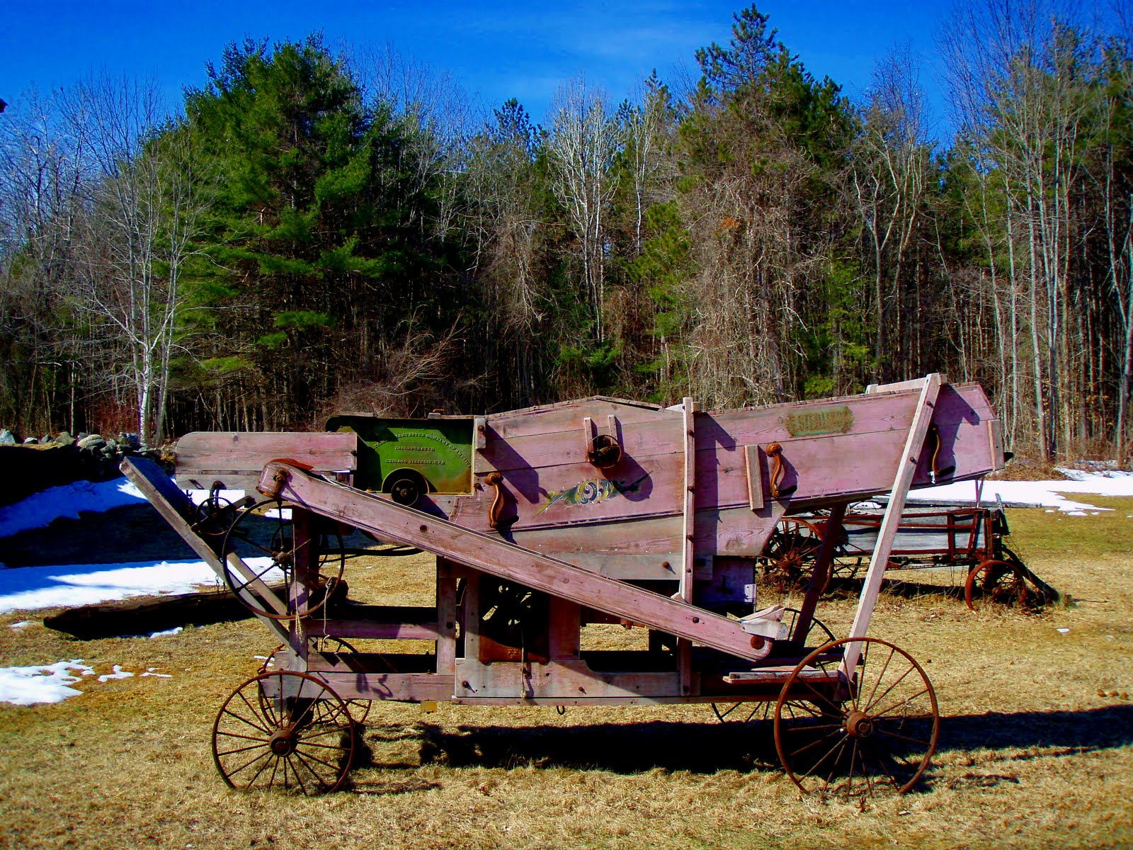
"NH Farm Museum" (pictures)
 (Directions) From Rt. 16 take exit 18. Take 125 S the farm will be located on the right.

Upon driving up to Chocorua Saturday for a day hike we quickly were reminded how different things can be just an hour North. Snow was still deep in the forest and on the open peaks. So before even stepping a bare boot on a trail we bailed on a higher summit/Northern hike. Bummed out we headed back towards Farmington. I decided on the way we would check out Copple Crown Mt. We drove up the road and at it's end the access road was still plowed in with a giant snow bank. The home owner here was working outside on some vehicles and gave us sort of a dirty look. So I made a quick U-turn and headed back out to Rt. 16. Strike 2!

Back on 16 I decided to get back off and check out the NH Farm Museum which I heard had some trails. I stopped at a SPNHF sign for Jones Forest. There was no trail present so I continued on a couple hundred feet to the farm. This large beautiful farm was closed but we got out to look around the grounds anyway. After reading some interpretive signs we made our way to the back where there was indeed some trails.

We began on the Cow Run Trail that follows in between two rock walls. We met some Turkeys and the went left onto Cemetery Trail which unfortunately ended with no cemetery in site. Back to the Cow Run Trail we followed it's course through the woods and back into a rock walled section where trees were blown over from what looked like a wind burst. The trail joins a logging road and returns to the farm. As we emerged from the woods we were met by a chipmunk watching us from a rock wall. Several trails are in this area marked with blue snow flake blazes and wood tree blazes. Sometimes easy to follow and sometimes not so easy.

"Mt. Teneriffe Preserve" (pictures)
(Directions) From Rt. 125 in Milton take Teneriffe Road. Continue under highway and half way up the hill a sign on your right marks the Preserve and parking.

After leaving the farm we continued on down through Milton. I spotted a road sign reading Teneriffe Road and re-called hearing there was a trail or something on this small peak. I decided to check it out. Sure enough partly up the hill we spotted a well built sign for the Preserve held by the Nature Conservancy. The land is recognized as one of five most significant Small Whorled Pegonia sites in the world. It is also home of two rare forest communities and two other rare plant species Squaw Root and American Ginseng.

We began our hike at about 11am. There is a kiosk set in the woods with a log book and paper brochure/map. We continued, this being the ledge trail, and crossed by many small ledges. A small loop trail was on the right call the Spur Trail which we passed by. Then we came to a large rock with an open view to the North. Onward past a large tree as we made a short, steep decent. Soon we reached another large tree and a trail junction for Back Mountain Trail. We continued straight down Ledge trail which brought us past more ledge and then to another junction with Back Mountain Trail.

Again we continued straight, through a rock wall and to a rocky area with a cairn. Moarning Cloak butterfly's were all over the place here! Just past this area was a ledge to the right that offered a partial view. Back to the trail junction we now took Back Mountain Trail which followed a woods/logging road down hill through the forest. At one point I noticed a disturbed area of rock and upon investigating I discovered a stone well and small foundation. Perhaps a logging cabin site?

The trail continued to drop before making a left turn back up hill past a large rock wall. Past another large tree, this one dead and up into a sunny clearing. Then down the banking back to the trail junction with Ledge Trail. We followed the trail back out passing a small family near the entrance. We finished this attractive loop at about 12:45pm. We compared our muddy boots, changed and headed home for lunch. A nice, well marked trail which will certainly see many more visits from me!

Stonehouse Pond 3/30, Abbott's Grant 4/3, Little Niagra Falls 4/6

"A Bunch of Little Hikes"

"Stonehouse Pond" (pictures)
(Directions) Rt. 202 in Barrington, turn onto Stonehouse Pond Rd. Park at gate in winter, drive down road and park at small parking area in summer.

Scott came home early on Thursday not feeling well. Both needing some fresh air he suggested we go do a small walk. It would probably be a good idea considering a possible 6-12 foot snow storm was forecasted for April Fools Day! I decided to head to Stonehouse Pond, always a pleasant walk! We parked at the gated entrance and began our walk down the road. It was cool out, but nice and sunny and the air felt good. We made our way to the pond shore and in the usual clockwise direction around the still frozen pond.

Trash was spotted along the shoreline and in some of the brush. Another reminder that I unfortunately need to carry a trash bag with we on my walks as there is always trash to be tended too..."sigh". The side of the ledge was still a little icy and I stopped to 'pop' some pictures. After making the steep climb up to the ledge we sat looking out over the landscape and just relaxed and enjoyed the view. Such a lovely little spot!


"Abbott's Grant" (pictures)
(Directions) From downtown Farmington take Old Bay Rd. Turn right at signage for Abbott's Grant. Tiny parking area.

After getting half a foot of snow Friday and more up North, we decided against any major weekend hike. Instead late Sunday afternoon we headed just down the road for a short dusk walk. We began to walk down the woods road but snow was still deep and loose. So I parked at the logging road just down the road and we walked the Cocheco River down to the old dam. It was very wet along the way with spring run off streams everywhere! The water was certainly flowing nicely!

"Little Niagra Falls" (pictures)
(Directions) First Crown Point Rd. in Farmingon, pass by Mt. Blue Job parking. Continue a little ways to Little Niagra Falls Rd. on the left. Follow this road to a turn around/parking area at the marsh shore.

I would be heading to a Yanni concert tonight and then off to 'Invasive Pests First Detector Training' at the Concord Audubon Society on Thursday. So it was nice to get out again for some fresh air. I figured I would bring Scott down to Little Niagra Falls and I had only been here once this past winter. The hike was very wet as snow melted. The marshes were pretty and the reflections of the blue sky and white puffy clouds in the waters was awesome!

As we checked out the cemetery at the highest point of the road a horse rider came flying up the trail. She was startled as she looked over to us standing there! We chatted briefly and she charged back down the trail. We arrived at a strongly flowing fall. It was gorgeous! I snapped as many pictures as I could before we had to head back to the truck.

On the return trip we picked up trash and left it in small piles along the road for future extraction. Earlier at the cemetery I mentioned that there must be an old foundation around unless the cemetery belonged to one of the older houses at the start of the road. But just before we reached the parking area Scott spotted it just off the road. A large stone foundation for a house and barn. And I also spotted a stone well which was uncovered. What a cool discovery! This is one of my new favorite little hikes in the area. A bit of a long drive for such a short walk, but if you use it as a warm up for a hike up Blue Job just across the street it would make for a perfect combo!