Pics of this hike
HERE

We were up very early, 4:30 Sunday morning after pushing Saturdays hike back a day due to possible Thunder storms for Saturdays afternoon. We awoke to the sound of rain and after watching the weather reports it didn't look good for this afternoon either. Wanting perfect weather for the hike up Great Gulf trail to Washington, and after some sulking and contimplating I thought it best to just stay in our area, something we do often when weather is unstable. I have been wanting to check out Pawtuckaway State Park nestled in Nottingham, NH for some time now. Just a 40 minute drive for us. Lighty packed we headed out. I decided to take the Northern part of Round Pond Road off of Deerfield road from Rt.107. Luckily I had my google maps on my phone which really helped in navigation. I passed the unmarked dirt road twice before crossing back over the Nottingham town line sign and finding the road on a corner. We followed it to a gate and small parking area. This parking area adds about .2 miles (one way) as opposed to parking at the end of the Southern part of Round Pond Road.

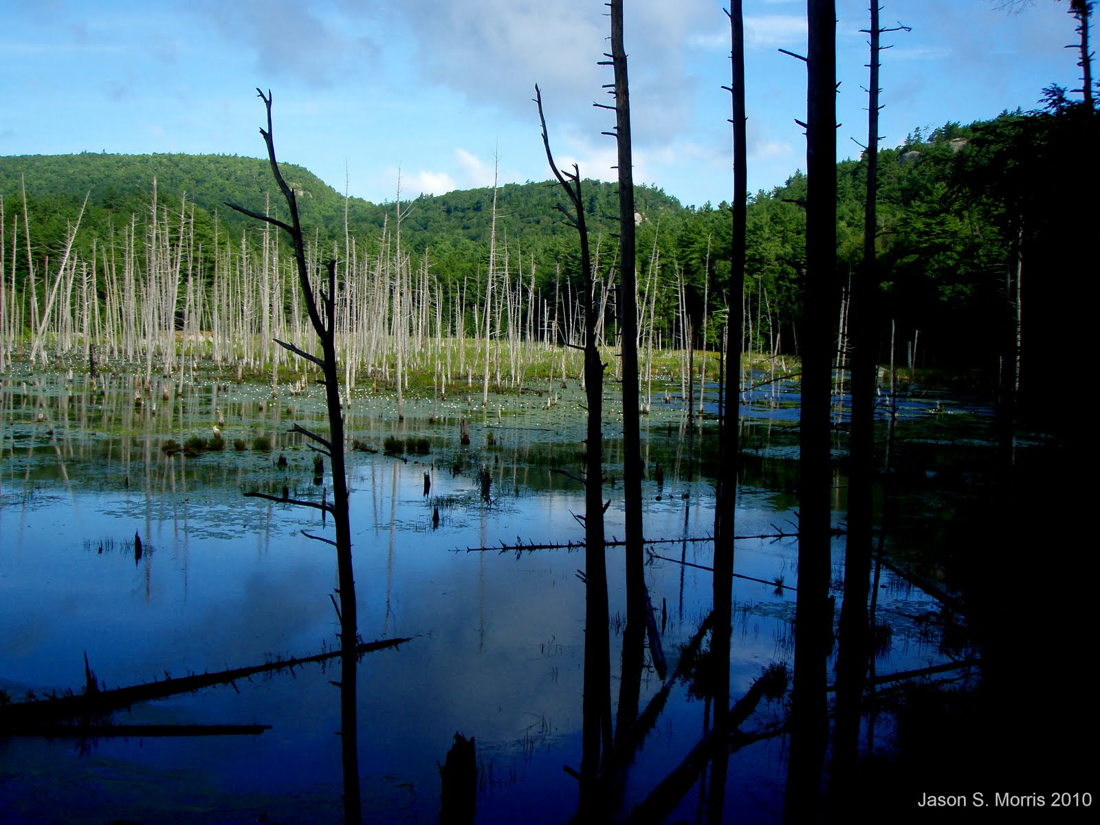
We began our hike down the gated road at 7:15am. You make a gentle hike down to Round Pond, passing some large boulder erratics on the right. Once at the pond you make your way around the flooded section of road and to the parking areas where there is a sign for the Boulder trail. Once on this trail you immediately find yourself amongst gigantic boulder erratics, as large as a house! Rock climbers were gearing up to climb one of these beastly rocks. You snake your way through these granite boulders and ledge, then find yourself flanked with granite on your right and a spectacular, frog and lilly filled marsh on your left with views up to the ledge dotted North summits. Oh, and lets not forget about the vertical rock slab rising about 70 ft. from the ground.
We arrived at the North Mt. trail and took a right onto it. Orange Salamaders were crawling around on the forest floor in the hundreds. I've never seen anything like it! Unforntunatlely the mosquitos and horseflies were also in large numbers, swarming us almost the entire trip. Passing by more boulders and ledges you arrive almost at the base of a steep vertical cliff and ledge where the trail bears right then left at a marsh. Here the trail climbs steeply over rock. Part way up this section a side trail leads through a large crevice of the ledge to what I believe was the only unobstructed 180* view on this ridge. I wasn't able to climb this steep, cliffy section as it was too wet and slippery from the mornings rain to risk it.

Onward we made our way to a ledgy area where there is an unusual large green communication reflector. The trail takes a sharp right here behind the structure and climbs past more wooded ledges reaching the summit (995') marked by a cairn and survey markers. Viewless and buggy we snapped a picture and continued on. Again passing wooded ledges with some obstructed views of the Middle and South peaks and the South Peak Fire Tower. Past these areas we began a steep decent down loose rock to a gated road. Here the North Mt. Bypass trail begins left down this road. We followed this gradual road, keeping left at another junction before arriving onto Round Pond Road. The trail then diverges back off the road where we decided to stay on the road for a straight shot back across the pond and back up the Northen park of the road to our parking area. We finsihed at 11:15am.

Rugged, steep trails provide rock scrambling and plenty of ledges (though mostly wooded). The pond and marshes were very pretty with the pond flowers in full bloom. The boulder fields were a sight to behold, likened to those you would find in the White Mountains. Litter, mostly beer cans along the roads, lake and boulder areas was dissapointing and very upsetting that so many who use this area have no respect for it! A rather pleasant hike despite the swarms of biting bugs (probably due to the rain and humidity) and despite the lack of views. If you are one who embraces the finer parts of hiking, not just after "the view", this area is sure to please!
Click on
"Park" for info. and map
Total trip was approximately 5 miles, 750' elevation gain, 4 hours.
Pics of this hike
HERE


what a great report of an area so little of us think of visiting. Beautiful serene pictures. I grew up camping at pawtuckaway park with my parents and brother and sister. My Dad loved it there and I have alot of great memories. We used to catch bull frogs right in those same marsh pics. Wow so long ago! Thanks Jason Morris
ReplyDelete