Monday, September 27, 2010

Welch-Dickey Loop 9/25/10

"Foliage, Ledges and Mushrooms, oh my!" (pictures)

What a spectacular day! After bringing Scott's mom (Paula) up Blue Job the other week we decided to bring her on a longer hike. She was up for another fun day with us! I set my sights for the always exciting and beautiful Welch and Dickey mountains at the entrance to Waterville Valley. We arrived at the parking lot early at 8:15am as to avoid the inevitable crowds. To my shock and dismay a bus full of kids was just beginning to unload. What are the odds I whined! We got our gear together and took off up the trail at 8:30 hoping to stay ahead of them, and that we did the entire day! The trail was gradual and we stopped a few moments to rehydrate and to check out a rock, or a tree formation, etc. Things got more difficult as we began negotiating wet rock slabs and steeper pitches.

We arrived at the Welch ledge just after 9:00am. The scree wall and circles of tree limbs protecting the outcrop communities looking larger and uglier than the last time I was here. Some growth looks better while other areas haven't really improved. We took a break and many pictures. We could see a pair of hikers with dogs on the ledge on the cone of Welch. Sandwich Dome is the prominent mountain in view, it's pointed Jennings Peak easily identified. And the easy to notice Tripyramids to the North. Then swinging around with an always wonderful view up to Welch and behind us to Dickey Ledge. So far, so good. Paula was doing good and we were having a good time.

Back into the woods and we soon began a steep climb over granite slabs and ledge before breaking out onto the large open ledge were we saw the hikers. We could now look back to the first ledge and could see the school group hanging out at it. Paula began feeling the hike at this point, as we all did. We forgot just how steep and tiresome this little hike can be. Scott kept saying "almost there" every 10 minutes which became the joke of the day. More ledge and rock scrambling through countless granite ledge and broken rock and finally arriving at the last steep section. Here we ran into the two hikers with 3 dogs. One of which ran up to Scott and began to bark at him. "I was about ready to get ugly when the owner finally got up and pulled the dog back, stating she won't hurt anyone...the usual remark. Paula was being funny and joking with us that she couldn't believe we took her up this mountain on just her second hike. But for 64 she said she was doing good, and with two new knees! The ladies heard this and were impressed as they then cheered her on as we laughed.


We made the final ascent and finally made it to the summit of Mt. Welch (2605') at 10:06am. Winds were whipping at a wonderful 30mph and the color of the changing trees was spectacular. We sat and had our lunch, taking in the view and the wonderful weather we were having. Paula had us laughing over the saying on the back of her "Honest Kids" sip drink, "Don't worry if your tasks are small and rewards are few, remember that the mighty oak was once a nut like you!" When we were ready we headed down the other side to the col where I found the first good mushrooms of the day! Then began the ascent of Dickey  mountain. More steep climbing with views across to the very pointed Welch summit cone. We quickly reached the highest point of Mt. Dickey (2734') at 11am. Views were great North up the ridge connecting to Tecumseh and the view to Franconia Notch visible and a bit cloudy.

Once across the summit area we made our way across and down ledge and into the trees past a granite wall and more mushrooms scattered about. Then the highlight of the day, the breath taking Dickey ledge. We sat and had another long break here taking in the panoramic view of Dickey and Welch and the valleys and peaks to our East and South. I could have spent the rest of the day just sitting and looking, the cooling breeze and warm sunshine with clouds rolling by overhead. These are two little mountains that will never get boring to hike. They are truly a NH treasure!

We continued the climb down, Paula really feeling the tough hike in her knees but she charged on, taking breaks here and there then right back at it. Acorns all over the ground were making the walk more painful and uncomfortable. We passed several people on there way up, all of whom were in good spirits and enjoying the lovely weather. We arrived at the trail junction, took a left and found a now full parking lot at 12:45pm. We drove off to Dunkin Donuts, an iced apple cider for me, a hot coffee for Scott and Paula a pumpkin iced coffee which was too heavy on the allspice!! I love fall hiking :) And Paula is a humorous person to have along with us. We all had a laid back, play-around kinda day! (pictures)


Total Trip time: 4:15
Total Mileage: 4.4
Elevation Gain: 1800 ft.

Saturday, September 18, 2010

Odiorne Point State Park 9/18/10

"Odiorne Point State Park" (pictures)
Having to work late Thursday and Friday night and with a long day of work scheduled for Sunday, I wanted to stay close to home this weekend. Scott and I headed for Portsmouth, walked the mall and had a always delicious burrito at Chipotle's. Then I thought we would drive over to the park in Rye and eat and walk the area. I had not been here since I lived in Rye 2001-2003 and Scott had never been. We walked the beach checking out the tide pools, rocks and views to Whaleback Light. I was excited to find a crab under a rock and further down the beach a small lobster! We got to the jedi and decided to head back to the truck. I remembered a trail nearby that went into the woods and past a bunker fortification. My memory served me well, the path now overgrown we found the main trail and bunker. Onward back to the beach then down another somewhat overgrown trail to the front of the park and back to the truck. A wonderful area, great for kids...no pets allowed :) The park does need work. Overgrown paths, fallen trees and branches and trash along the beach are numerous. I was rather shocked to see the park (at least this side) in such disrepair! A nice area non-the-less. Views are great to Fort Stark, Whaleback Light, Wentworth by the Sea Hotel and the 100's of sailboats, fisher boats and even freight ships off in the distance.

Friday, September 17, 2010

Doles Marsh & William H. Champlin, Jr. Forest Reserve 9/16/10

"Happy Marshday!"

Doles Marsh (pictures)
Today was slated in for having my monthly lunch with my Gram in Epsom. She usually calls the day before to give me a reminder. No call I wondered if she'd forgotten or just figured it was on my calendar and that I'd remember. I figured I'd not bother calling and if we don't meet up I would check out the Pawtuckaway South Peak Fire Tower. When I arrived on Rt. 4 in I called and she said we are supposed to be doing lunch next Thursday. I said OK (even though that was supposed to be the back up date, and now I guess it was) and I googled mapped Mountain Rd. on my phone. I followed 107 down passing the street several times before realizing it started out as reservation road. As soon as I pulled onto this road a sign read, "no park entrance, use entrance off 156". Well, I've had enough of driving and I am no longer in the mood for driving around to the other side of the park. So I headed back up 107 and stopped at a sign I had seen on Rt. 43, Doles Marsh, NH Fish and Game Dept. Waterfowl Management Area. I pulled down the road and into the parking lot.

A logging road left the lot (clockwise) to a small dam and a beautiful marsh. I crossed the dam and followed the road 300 feet or so before it became pretty overgrown. Not dressed for this sort of excursion and not feeling comfortable in new territory wilst alone, I turned back. On the other side of the lot a faded path (marked by little orange tacks in the trees) leads to the middle of the marsh and affords a great view. I was startled when the frogs began jumping into the water. Picture the sound of a squeaky toy, that sound times a hundred ... squeak, squeak, squeak .... it was hilarious! There were a few birds, a few killdeer and a hawk. But imparticular were two sand pipers of some kind about 30 feet in front of me just watching. I crouched there for about 10 minutes just listening to the sounds of the marsh. Then back to the truck.

William H. Champlin, Jr. Forest Reserve (pictures)
Not quite satisfied with my day yet started to ponder where else to go. There are so many forests and wildlife reserves around. I decided to head to Rochester to the Forest across from the Sky Haven Airport off of Rt. 108. I had been here once last year and have been wanting to return to document the route and get some pics. I began my walk at 2:00pm. The trail begins by crossing a small field then into the woods following a logging road. Follow the yellow plastic markers. When you see a yellow arrow at a fork, you can continue straight which will bring you to the Upper Pond (.4 miles). I went this way and found what is left of the pond. With the dam removed it is now a dried up lowland of grass and such. There is a sign that reads "end of trail", and if you continue down the banking there is a small stream or puddle is more like it. Here I made a friend with a frog. He jumped into the water at first, then climbed onto the rock I was standing on. I took a close up picture, I have never seen a frog so calm! I took some pics of a large bed of yellow flowers (yellow queen I think) and went back up the trail to the junction.

Back on the main trail you follow the logging road. Chipmunks and squirrels making a racket in the woods, along with acorns falling from the trees and the occasional hum of a prop plane engine landing and taking off. You will walk through a large pine grove just before entering the Lower Pond, where a brown arrow points left. If you stay right you will enter another, larger dried up pond. Dead tree stumps and rocks poke up from the grass covered ground. If you continue along the banking you will eventually come to a no trespassing sign. There is a rock wall which cuts through the marsh. I walked down it to it's end ion the middle of the marsh and took some more pics of the pussy tails that were "poofing". I checked out an old beaver dam, now on dry ground and headed back to the trail. The trail now passes by some granite quarry sites (off trail) then loops around back to the main trail. A rather large garter snake crossed my path, which I coaxed pretty easily into "attack mode". I snapped a picture and took off, headed back to the parking lot, passing another loop option which I didn't realize was there until I checked the map at the entrance. I got back at 3:00 and was pretty disgusted with all the trash in the parking lot and just at the woods/field line. Having a box of trash bags in my truck, I figured I do a little something. I filled a 33 gallon trash bag...grrr! It looks as though the same person takes lunch brakes there, as the same cigarette box and aroma joes cups were found in multiple numbers. Perhaps sometime when I am feeling pissy, I'll stake it out and try to catch this jerk. Mileage for this trip was 1.9 This forest is a great spot for a leisurely walk and is great for kids!

Monday, September 13, 2010

FOT48 Passaconaway 9/11/10

Flags on the 48, Saturday September 11, 2010.
Pics HERE

We arrived bright and early at Ferncroft parking lot just after 6am. A van was there and a car pulled in just before us. Scott's first FOT48 hike and my mom made a day-before decision to come along, her and I on our second year. We geared up and headed to Old Mast Rd. The two who had pulled up before us asked if we were with FOT48 for Passaconaway. I said yes rather surprised, as I wasn't aware of anyone signing up. They (Andy and Jess) said they had a day or two ago and that they had sent me (or someone?) an e-mail. I kinda started things off rude by telling them my mother hated dogs (as they had one with them). Probably not the best thing to say to strangers who would be joining us, but I just wanted to ensure my mother's and my enjoyment of the hike without a loud, out-of-control dog. The dog, Skyler turned out to be very well behaved however so it all worked out fine. Sorry for the rude introduction!

Off we went taking the Kelly trail. I knew this would be a bit more ambitious than some of the other, easier routes to the summit but I wanted to make a day of it and explore a new trail that I have been wanting to hike. Kelly trail was well maintained and we kept a very good pace, stopping shortly now and then for a quick swig of water. Jess had done two hikes up Katahdin this year and Andy from what I gathered  has not done a whole lot of hiking and was asking plenty of questions and seemed to be really enjoying the hike. The trail stayed rather gradual and got interesting at Paugus Pass where the trail climbs through a narrow gully similar to Ice Gulch, but lacking the boulder filled floor. Layers of rock shelves formed walls on either side of us. My mother got her hair bun caught in branches twice. And Scott and I forgetting we had poles rising over us, got caught a couple times on branches and a couple of head height blowdowns. So we a few good laughs! Then at another point my mom and I bent over to look at a moth on a birch tree bringing my flag poles in contact with her head. It was a pretty hard hit, but no blood thank God! We arrived at the Square Ledge Branch trail where we took a break. The SLB trail makes a steady climb up to Square Ledge trail where you climb steeply, with views ahead through the trees of Square Ledge. The trail brings you just below the ledge, then swings right of it and climbs beside it and through a stone trough of sorts. Once above and just past this a view spot on a steep ledge is on the right overlooking the large mass of Mt. Paugus. We took another break here.

The trail now drops to a col then climbs steeply up to the Passaconaway Cutoff trail. Here we met 3 guys who started from the Kancamagus Highway carrying a flag that had hung over the US Embassy in Afghanistan. We chatted shortly then began climbing down dropping to another col. passing a view spot to Whiteface. Then we steeply climbed to the base of Passaconway's cone. A final steep push up Walden trail brought us to a level area. The trail swung around right and past a large flat rock with views towards Chocorua and North to Washington. There was a group of 5 with large camping packs on the rock, so we continued on as we wanted to get the flag up anyway and find the North View spot for lunch.

We passed the North view sign and soon found the summit sign to our left, right on time at 11:45am. We began assembly and I decided to scale a tree this year as I had done the year before on North Tripyramid. After several attempts to secure the pole to the tree, we finally had it set in place and secured. Unfortunately there was very little wind up here. But now and then a small wisp of wind would bring the flag at attention. Several people were there taking pics including the group we had met earlier who opened there flag for a picture, then headed back down before I even had a chance to see it and take a picture. We now made our way to the North view spur path which climbs down annoyingly, .3 miles and 200 feet to what turned out to be a small ledge where the group of campers had migrated to. We unpacked our lunch and huddled along the trail to eat, and once the group headed back up at about 1:00, we took possession of the space to take in the glorious view.

The view was spectacular. The entire White Mountain National Forest opened up in front of us! Cloud covered Mt. Washington in the middle, flanked on the left by the southern Presidentials, the Pemi Wilderness, Franconia Notch, the Hancocks, a spectacular view of Carrigain and it's notch, the Dry River Wilderness, the Osceola's and the Tripyramids. And to the right, ledgy Hedgehog Mtn. directly below, the Moats, Chocorua, Kearsarge North, Wildcat, Carter Dome and the Baldfaces. One of the best sweeping view spots I think I have seen!

About 1:30pm we headed back up the trail and decided to drop our bags at the view spot to the West of the summit overlooking the Tripyramids. I took off to snap pics of the flag and over the the East view spot we had passed earlier. Then we began dis assembly of the flag. We began our decent at 2:00pm. The first section was very steep. Jess slipped on a rock catching herself from falling. Then I did the same thing on the same spot, twisting my ankle to the point of pain and burning. Very thankful that it didn't sprain or fracture! Must be all the hiking this year keeping my joints flexible. The burning feeling went away after about 10 minutes and no pain, phew! We were clearly a bit tired and this steep section was getting the best of us. On another steep section my mother made a wail and I turned back to see her crash to her knees and into the pine trees! This can't have a good outcome! But once again someone was watching out for us, my mother's knees landed on a bed of thick moss! She walked away from this wipe out with a small scrape on her arm from landing in the trees. Another catastrophe averted we got moving again.

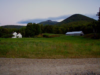
Jess and Andy took off down the trail at this point to meet us back down at the bottom. We slowly made our way to the switchbacks where the trail eased and stays at a gentle grade down Dicey's Mill trail to the Ferncroft road and parking lot. We passed a few people thanking us for our efforts and passed many making a late ascent. Onto Ferncroft road and past the picturesque homes, we arrived back at the parking lot at 4:30pm and very happy to get the boots off and throw a fresh shirt on! We said our farewells to Jess and Andy and headed out. A great day, perfect visibility, temperatures and trails. Couldn't have asked for a better day.
Thanks to all who participated in FOT48, God Bless America, may Freedom ring from mountain top to mountain top!

Trip Totals:
Mileage - 11.5 miles
Elevation Gain - about 4,520 feet
Time - 10 hours

Pics HERE

Tuesday, September 7, 2010

Moosilauke South Peak 9/6/10

"A 4000 Footer, Kinda"

Pics HERE
Scott and I had made several attempts to reach Moosilauke's South Peak via Glencliff trail, but each time were turned back due to bad weather. Today looked very promising to finally reach this 4, 523 foot mountain. Not on the list as a 4000 footer however because it doesn't meet the specicifications. Either way it was very much a 4000 footer hike to us! We began our hike on Glencliff trail at 7:30am with long sleeves and hats on, fall has arrived in the mountains! The trail passes through and next to some fields before reaching Hurricane Trail junction and now climbs moderately here on out with good footing. About a mile in we could here the eerie sound of Loons from one of the distant valley ponds.

We climbed what seemed like forever before leveling out as the trail turned North. Elevation was slowly gained until the trail swung East again and climbed steeply over rocky ground before finally opening up to some partial views as we passed a group of campers. We passed a talus slope to the right that had beautiful views West and soon we arrived at the spur trail to South Peak summit. Marked by a sign post (sign was missing) and a well beaten path due South. The trail follows a small ridge, then climbs and we finally reached the open summit at 10:00am. Views were great West to rocky Webster Slide/Blueberry/Black mountains with Mt. Clough's slide scarred slope and mud ponds right in the forefront. North was the impressive Moosilauke Peak and it's ridges and subsidiary peaks. And North and East to Franconia and Crawford Notches, the Pemi Wilderness and Mt. Washington to name just the main areas. The wind was blowing with temps. near 50 so we hunkered down and had a quick bite to eat. 

We did what we came to do, had great views and thus decided to call it a day. Heading down was rough the first part. Steep and rocky and many people coming up, much more than what I had expected. Once the trail got back to easy footing we hustled down getting back to the parking lot at 12:30pm. A lovely day and a pretty rough hike for what you would think would be a walk-in-the-park. 6.4 miles, 3063 feet elevation gain, 5 hours.

Pics HERE

Sunday, September 5, 2010

Fort Williams & POrtland Head Light 9/4/10

Looking for a change in pace and a relaxing Saturday Scott and I decided to head to the Maine coast. With the long weekend (Labor Day) we could save hiking for Monday. We made a stop in Kennebunkport to see George H.W. Bush's home then headed for Fort Williams in Cape Elizabeth just South of Portland, ME. Busy but not crowded we walked the entire grounds around Portland Head Light, the cliffs and down and around the various bunkers and Officer's home sights. I'd not been here since a teen and it was fun checking out old memories and finding things there I hdn't seen before. It was a great trip, highly recommended for all, especially those with kids!

Pictures HERE