Showing posts with label foliage. Show all posts

Monday, October 25, 2010

Goodwill Conservation Area 10/24/10

"A Barrington Find on a Yucky Day" (pictures)
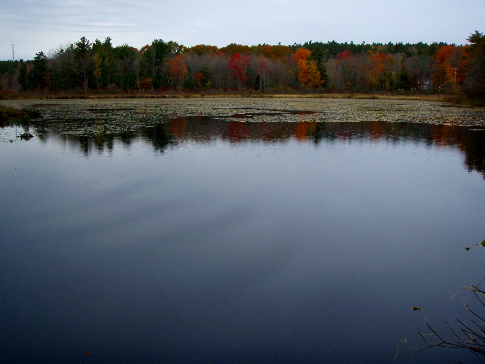
OK, so it wasn't THAT yucky. Scott had to work Saturday and of course that turned out to be the nice day of the weekend. With rain showers forecasted for Sunday afternoon I figured we'd once again stay close to home and hike Mt. Major or something. Well, between rising late and having too much to do for the day we never made it anywhere. I had some work to do in Dover and Barrington so I decided to snap some pictures of the areas old buildings and cemetery's. It was after I left Barrington's Pine Grove Cemetery that I noticed a sign as I "wizzed" by, "Goodwill Conservation Area". And as you might guess I turned around! There is a small parking lot in the trees. This area was protected in December 2007 and is 156 acres!

You are immediately greeted by a pond, Richardson Pond I believe is it's name. The trail begins by climbing over a gated bridge (why there is no pedestrian throughway I don't know!?) and you find a path to the right and a logging road to your left. I took a right as the path followed the pond. After a short ways the trail makes a tiny loop and you end back at the start.

Now I headed up the logging road. It's starts off at a gentle ascent about 100 feet in elevation. I figured I'd run into someone as there was a vehicle parked in the lot. Sure enough I came across a lady walking her dog. I asked about the trails and she was very nice in giving some info. I continued on over another hill until I came to a sign that read "Ledges Trail", and some other ski mobile "mumbo jumbo". Apparently this is part of a ski mobile trail network in the winter. You now pass several ledges in the trees and as you make your way down the hill a large ledge on the left beckoned me. I climbed up to the top of it to find a trail. I followed it to a beaten path to another open ledge, then decided to go back to the main trail. I walked down to the end of the ledge to a fork in the road and a diamond sign. The lady had told me this was not a loop. I wasn't sure which way to go and since it was sprinkling I decided to head back before it got really wet as I wasn't dressed to be out in the woods!
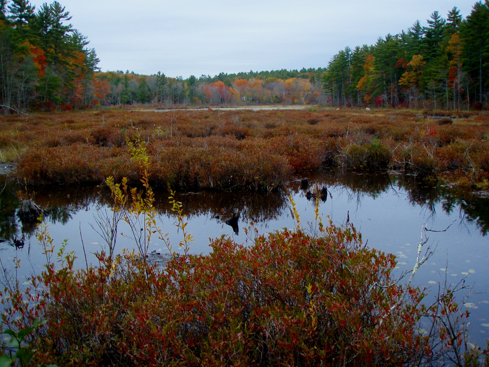
So back I headed, climbing to the top of another ledge finding another semi-open rock slab. Then back down the trail hoping the rain would hold off. I caught a glimpse of something red in the dirt road, and spun around to investigate. It was a red-walled tire that read "US Royal", which upon some research are tires that were used in the 1960's and years prior. Neat find, I thought! I made a stop at the marsh I passed earlier, bushwacking to it's shore for a clear picture. Back on the road I did a tick check and got back to the pond for more pictures before heading home. Distance was about a mile (1 hour round trip) with the pond loop and logging road. I will have to investigate further where the other roads go to on a better day. (pictures)

Wednesday, October 20, 2010

Mt. Blue Job 10/19/10

"The 3 J's" (pictures)

Difficulty: Easy - Moderate:
Fire Wardens trail on South and East side of the mountain is steep and wet with loose footing.
Loop trail which follows part of the access rd. is moderate but easy footing.
Gray Hill or Little Baldy Knob trail is easy with some easy rock scrambles.

Directions: From Rt. 11/N Main St. in Rochester, NH take Rt. 202A. Just past the "4 Corner Store" take your first right at a corner onto First Crown Point Rd. Follow it for approximately 5 miles. The parking lot is on the right (signed) just over the hill. 

Report: My brother Jeremy decided to come over today, his day off, with his son Jonathan (JJ). He had said that He had been bringing JJ on some woods trails and that he really enjoyed it. So I told him we should give Blue Job a try. This would be JJ's first mountain hike! We got to the trailhead at 1pm, there were several cars parked. JJ was excited to get going! So off we went. We quickly made our way through the forest, JJ running most the way, taking a tumble every now and than! Pointing out the features, "look at that rock", "look a bridge, oh a waterfall", "come on you guys!" We then began the climb up the rock slabs of the knob which JJ was having a lot of fun with.

We reached "Little Baldy" knob at 1:20pm, there was a couple people up here. The view today was spectacular! The color of the trees in peak foliage, the clouds a puffy white, a warm sun and cool breeze, and Mt. Washington graced in his winter jacket of snow and ice! It really was the nicest view I've had up here yet! After spending a good amount of time here we then made our way down to the pond where we again hung out for a bit. Then it was the steeper hike up Blue Jobs cone.

This is where JJ began to get a bit tired. We pushed on and he snapped back out of the whining when we arrived at the Fire Tower. "Can we climb the tower?", "Can we climb the tower?", "Can we climb the tower?"  .... repeated all the way to the stairway! Up he went as excited as could be. We joined 2 other people on the tower, took in the view then dilly-dallied around the wardens cabins and rock area. We then made he descent back to the car, JJ off running again down the trail, falling and running. He sure does enjoy the woods. Can't wait to introduce him to the Whites as he grows older! We finished at 2:15pm (pictures)

Monday, October 18, 2010

Kimball Forest/Lockes Hill 10/17/10

"A lovely hill, a magnificent Castle" (pictures)
Well, having extra work this weekend and having to work both Saturday and Sunday, we once again decided to stay close to home. We slept in a bit and once up and ready we headed for the Belknap Range. Scott had been reading about Round Pond on Mt. Belknap and I had yet to explore these close-by mountains that I grew up next to but never knew about. Sure, I grew up skiing Gunstock but hiking wasn't really on my mind then. Anyway, the plan was to hike to the pond then ascend Belknap Mt., looping down Gunstock and back to base. To make a long story short we headed down a logging road we thought was the trail. It didn't seem right so we headed back to the lot to look for any sign of a hiking trail. There was a sign that read all hiking trails start here. And a trail name of "Acid Deposition Trail". Huh? This wasn't in any trail descriptions! There was a trail that headed up between th ski trails which I concluded was what we wanted. I ran back to inform Scott. He wasn't convinced, and didn't want to be walking up and down trails aimlessly all day. So back in the truck I picked my brain. I remembered a trail I took with the AMC group back when I was in middle school. I remembered a wooded summit with a small fire tower. I knew it was off Rt.11 and remember seeing the brown hiker sign before. I made the mistake of heading back towards Mt. Major, turning around at the quickly-filling-up parking lot then heading back up past the Gunstock turn and up past Ellacoya State Park and the spot I was looking for a mile or so further on the left.
Now the trip report starts! The parking lot for Kimball Wildlife Forest and Lockes Hill was a good size and still empty. We got started at 8am as Scott checked the trail guide mailbox, with brochures in them much to my surprise. It gives the history of the hill and a trail map. We began counter clockwise, that being Lakeview Trail. You make your way on very gentle grades passing by nature intreptive signs. After sign 2 the trail makes switch backs up steeper terrain passing some trail side rock walls and boulders. We reached the Glade at 8:30am. This is a neat area. Much like the lower ridge crest of South Baldface mountain in that people had built chairs and benches out of the granite rock. They look out to a nice view of Lake Winnipesaukee, the Sandwich Range and Mt. Washington (which was in the clouds). There is also a fairly new binocular scope "thingy" (I don't know what they're called!) and I was able to actually find Castle in the Clouds, how awesome!

Onward we arrived at the powerlines with another partial view to the lake and just caught a plane flying by at eye level! Following the lines up to the Plane beacon where the summit of Locke's Hill (1057') is marked by a small cairn. Beyond here there is a ledge with a nice view to Belknap and Gunstock Mts. and house and farm dotted hills in the close by foreground.

Back to the beacon the Quarry trail brings us back down for the loop. You pass by some nice oak trees and soon will notice Granite Quarry sites, long abandoned and overgrown. These sights were used primarlily to build Lockes Hill Castle. According to the brochure it was built in 1897-1899 and owned by Benjamin Kimball who was a successful Concord businessman and new president of the Boston and Montreal Railroad. The castle was built inspired by his trip along the Rhine River and the Castle's he saw there. After his death the castle passed to his wife, his daughter-in-law, a trust, then to the Town of Gilford and ultimately to private hands. To be continued....

We began to pass many pairs of people now as the trail descends easily and then drops down into a quarry with a small pond in the middle. The trail then follows a small river, past more quarries, past a tree damaged area from the '98 Ice Storm and ends at the parking lot. We finsihed at 9:30am. Not the mountain I was looking for, but glad we checked it out. 1 hour, 1.8 miles. Many dogs on this trail, very kid friendly and a nice leisulrely hike with a handful of nice outlooks. Should make a great winter hike for this winter!

Still puzzled as to where the castle was, I headed towards Laconia keeping an eye out to the left for a sighting, or a road or something...then I saw it, Locke Hill road. Up the road to it's end there is a long driveway up the hill with "No Tresspassing" signs. The chain that should be across the driveway was down so I figured either the public was welcome or someone lived there. Up we went anyway! And sure enough there it was to our left. At the top of the hill the driveway passes through the middle of a fallen down barn and 3 abbandond cabins. And then the castle came into full view. Empty, falling apart and just sitting up there a complete waste! How sad. A beautiful structure and a view to match. I would do almost anything to own this parcel of land. It's sad to think that whomever owns it is just letting it rot, and apparently not allowing the public to see this bit of Lakes Region History. We left with thoughts running through our heads of winning the lottery and restoring it. Something that I will probably never get off my mind. (pictures)

Tuesday, October 12, 2010

Mt. Webster 10/11/10

"WWJD" (pictures)
No, not WhatWouldJesusDo? ... that's so 1990's! More like WetWebster-JacksonDitched. The story begins on Friday night when I felt a cold coming on. Sure enough Saturday morning I awoke to a sore throat and not feeling too good. Saturdays work done I wondered what Sunday would hold. Still not feeling too well Sunday morning, we scrapped plans for checking out some spots in the Belknap range and hung around home. Well, not the "holiday" weekend I was planning on so far }:-( But nothing was stopping me from hiking Monday! We would decide in the morning what the objective would be. I awoke 5am, feeling a little better and ready for some hiking. Scott was unusually slow in getting going, but we got ready and headed out. I decided to head towards Crawfords Notch, hoping that traffic would not be a problem today. The roads were pretty clear and I was shocked to park at the nearly empty Highland Center parking areas. I had expected this usually packed area to be a little busier, OK by me! The plan was to do a loop over Webster and Jackson. Something that I have wanted to do for awhile but wanted to avoid the crowds that flock this area. So far so good, aside from the thick cloud cover that enveloped the area. "It will rise and clear out", I assured myself.

We began up the Webster-Jackson trail at 8:20am. A gradual hike ensued up a wet trail. Scott was falling behind me, which wasn't the "Ascender" Scott that I have seen throughout this past year. We arrived at the Bugle Cliff outlook where Scott anounced he wasn't feeling well. That made two of us! His stomach bothering him, my throat bothering me, and both of us sniffling and whining! We checked out the nice but clouded view noting the Elephant's head ledge that we by-passed on the way up and the Highland Center and Mt. Washington Hotel beyond. Winds were whipping good, but the sun was shining brightly to the far North and South, so I continued thinking positive that it would break for us by the time we reached the summit.

The trail now began some steep pitches broken up by nice level sections and rock steps and stairways.We slowly continued on to the Webster Branch loop section. This section drops steeply to the Silver Cascade. Scott ahead of me now suddenly slipped on a flat, semi-vertical rock. Catching himself at first than loseing his footing and dropping and rolling into the very thin brush nearly rolling over a 30 foot drop. Yikes! Well out of "helping" range all I could do was watch. Once the scary ordeal was over Scott composed himself and retrieved his water bottles in the brush. Now on top of Scott not feeling well, he was suffering from a sore wrist and ankle. He felt good enough to continue so we made our way to the bottom of the banking to the pretty cascade, then back up the steep wall on the other side. We began to talk about how a simple slip really can be deadly in the mountains and how lucky it was that he rolled into the brush instead of tumbling into it, as there is no way it would have stopped him.

The trail leveled off and continued in steep and level pitches. Then remained steep over partly open ledge up to the summit. We arrived at Webster's rock spired summit (3910') at 11am. Conditions were not what I had hoped for. The cloud ceiling hovered just over 4000 feet. The sun had yet to break through. It was windy and cold. The awesome summit area would have to be enjoyed another time as we got cold very quickly. Once back into the tree cover we planned the next move. I really wanted Jackson so I could cross another 4K off the list, but conditions were not very good and it didn't look like they would improve. We did not plan on winter-like conditions and Scott being slightly injured we felt it best to skip Jackson and just head back the way we came.

This turned out to be a smart move, as the wet trail now icing over in some spots was slow going. We passed several people coming up, also expecting better weather and we made our way back to the cascade. Scott having a particularly hard time with slipping and a branch grabbing hold of him. It seemed this mountain was out to get him! Back to Bugle Cliff for once last look, views began to open up (go figure), then back down to the Elephant's head spur trail. The day cut short, I decided to check this out since there was extra time. Scott stayed behind. .2 miles never sounds long, but sometimes it sure seems it. The ledge is a very nice and large. It puts you smack dab over the highway with a fabulous view up and down the notch. Just as I was wrapping up this quick side trip a train horn sounded. Wow, what timing! I had to wait for the train! Just then Scott popped up over the ledge. He decided, "what the hell", I'm here, mine-as-well check it out. We watched the train go by and stop at the Crawford Station, then made our way back down to the truck...finishing at 1:00pm (pictures)

Not a bad day, just not ideal. Still a nice hike with plenty of features to enjoy along the way. I will certainly be re-doing this peak on a clear day via the Webster Cliff tail. After this hike we of course had to make the short couple mile drive up to the Mt. Washington hotel to check the view. The high summits now in the clear and Washington and surrounding high summits looking very cold and frosty! The Whites are so beautiful!

Friday, October 8, 2010

Abbott's Grant and Meetinghouse Park 10/8/10

Abbott's Grant (pictures)
With such a wet, crummy weak and not able to get out and enjoy the foliage today's fabulous weather had me itching to find some woods to disappear in. I printed out a bunch of State, town, fish and game, and NHFS PDF's with plenty of spots in my area to find. I headed down Old Bay Road in Farmington headed to check out Coldrain Pond in New Durham. I spotted a sign I have passed before and had yet to check out. I stopped, sign read "Abbott's Grant, Farmington Town Forest". So I parked in the very small parking area with another sign that read "Waldron's Woods". This area seems to have an identity crisis or something! After scratching my head in confusion off I went down the gated logging road!

The trail travels through the woods and to the Northern most tip of Waldron Pond and Cocheco River. It then passes a small marsh and continues through the woods passing a camping area on the right. Once past this you come to another marsh along Cocheco River. The trail follows back from the marsh and narrows where there are orange tape markers. I assume this marks the property line, but perhaps not. You enter an area that has been logged within the past couple years with skidder roads going every which way. I would say it was 1/2 a mile to this spot.

Not sure if I was still on town property and not wanting to get lost I made my way back, noticing on my left just past the campsite a stone cellar hole. Back to the truck I decided to walk back down the road to the bridge to view the pond from there. On the way back I noticed a logging road across the street, a cable across it and yellow signs reading "Absolutely no ATV's". I took this as meaning walkers are welcome so off I went. The road brings you to the edge of another marsh of Cocheco River and I could see an old dam on the far South end. I continued down the road and noticed a narrow path to the left. This must be a path to the dam, I figured. Sure enough after winding around a hill I arrived at the old dam. It was an interesting structure, the middle knocked out and a nice cascade. After investigating this spot I continued on the path which ended at another camp area with a fire pit and tree platform next to a cascade.

"Meetinghouse Park" (pictures)
Back on the road I decided to can my trip to Coldrain Pond and stop up the road at the Meetinghouse Park. Another place I had often passed by and was unaware of what was there. Besides the 1772 meetinghouse, there are a cattle pound structure, a pauper's grave (the oldest in New Durham) a vernal pond and 3 loop trails. The trails were small and were not in any sensible order but it was a nice short walk in the woods, something that would be great for kids or older folk who don't get out much. The trails were very easy to follow and well taken care of. I went around in circles in order to walk each loop! Would be a nice little walk in the winter too. Not sure o distance but it is less than 1/2 a mile. That wrapped up the day. Glad to get out in the woods and explore some more spots near home. And got the foliage views I wanted. Hoping to get up to the Belknaps and Whites this Columbus Day weekend! :)

Monday, September 27, 2010

Welch-Dickey Loop 9/25/10

"Foliage, Ledges and Mushrooms, oh my!" (pictures)

What a spectacular day! After bringing Scott's mom (Paula) up Blue Job the other week we decided to bring her on a longer hike. She was up for another fun day with us! I set my sights for the always exciting and beautiful Welch and Dickey mountains at the entrance to Waterville Valley. We arrived at the parking lot early at 8:15am as to avoid the inevitable crowds. To my shock and dismay a bus full of kids was just beginning to unload. What are the odds I whined! We got our gear together and took off up the trail at 8:30 hoping to stay ahead of them, and that we did the entire day! The trail was gradual and we stopped a few moments to rehydrate and to check out a rock, or a tree formation, etc. Things got more difficult as we began negotiating wet rock slabs and steeper pitches.

We arrived at the Welch ledge just after 9:00am. The scree wall and circles of tree limbs protecting the outcrop communities looking larger and uglier than the last time I was here. Some growth looks better while other areas haven't really improved. We took a break and many pictures. We could see a pair of hikers with dogs on the ledge on the cone of Welch. Sandwich Dome is the prominent mountain in view, it's pointed Jennings Peak easily identified. And the easy to notice Tripyramids to the North. Then swinging around with an always wonderful view up to Welch and behind us to Dickey Ledge. So far, so good. Paula was doing good and we were having a good time.

Back into the woods and we soon began a steep climb over granite slabs and ledge before breaking out onto the large open ledge were we saw the hikers. We could now look back to the first ledge and could see the school group hanging out at it. Paula began feeling the hike at this point, as we all did. We forgot just how steep and tiresome this little hike can be. Scott kept saying "almost there" every 10 minutes which became the joke of the day. More ledge and rock scrambling through countless granite ledge and broken rock and finally arriving at the last steep section. Here we ran into the two hikers with 3 dogs. One of which ran up to Scott and began to bark at him. "I was about ready to get ugly when the owner finally got up and pulled the dog back, stating she won't hurt anyone...the usual remark. Paula was being funny and joking with us that she couldn't believe we took her up this mountain on just her second hike. But for 64 she said she was doing good, and with two new knees! The ladies heard this and were impressed as they then cheered her on as we laughed.


We made the final ascent and finally made it to the summit of Mt. Welch (2605') at 10:06am. Winds were whipping at a wonderful 30mph and the color of the changing trees was spectacular. We sat and had our lunch, taking in the view and the wonderful weather we were having. Paula had us laughing over the saying on the back of her "Honest Kids" sip drink, "Don't worry if your tasks are small and rewards are few, remember that the mighty oak was once a nut like you!" When we were ready we headed down the other side to the col where I found the first good mushrooms of the day! Then began the ascent of Dickey  mountain. More steep climbing with views across to the very pointed Welch summit cone. We quickly reached the highest point of Mt. Dickey (2734') at 11am. Views were great North up the ridge connecting to Tecumseh and the view to Franconia Notch visible and a bit cloudy.

Once across the summit area we made our way across and down ledge and into the trees past a granite wall and more mushrooms scattered about. Then the highlight of the day, the breath taking Dickey ledge. We sat and had another long break here taking in the panoramic view of Dickey and Welch and the valleys and peaks to our East and South. I could have spent the rest of the day just sitting and looking, the cooling breeze and warm sunshine with clouds rolling by overhead. These are two little mountains that will never get boring to hike. They are truly a NH treasure!

We continued the climb down, Paula really feeling the tough hike in her knees but she charged on, taking breaks here and there then right back at it. Acorns all over the ground were making the walk more painful and uncomfortable. We passed several people on there way up, all of whom were in good spirits and enjoying the lovely weather. We arrived at the trail junction, took a left and found a now full parking lot at 12:45pm. We drove off to Dunkin Donuts, an iced apple cider for me, a hot coffee for Scott and Paula a pumpkin iced coffee which was too heavy on the allspice!! I love fall hiking :) And Paula is a humorous person to have along with us. We all had a laid back, play-around kinda day! (pictures)


Total Trip time: 4:15
Total Mileage: 4.4
Elevation Gain: 1800 ft.

Friday, October 23, 2009

Poem "Winter upon the Peaks"

"Winter upon the Peaks"

Winter is falling upon the peaks,
Autumn is all but past,
The gusty winds howl and shreak,
Iceicles shatter like broken glass,

The trees above sway and creak,
As whispy clouds hurriendly pass,
The forest colors past their peak,
Browns and grays rudely clash,
An icy river a glistening sheet,
Water below still flowing fast,
Sunshine on frost a chilly treat,
Causing a glittery rainbow flash,
Here and there do animals peek,
Gathering food before winters blast,
All around the land looks bleak,
Snow covers the frozen grass,
Frigid air numbs nose and cheaks,
Stinging like the taskmasters lash,
The mountain top still I seek,
Trudging on ... their at last,
A barron land that still entreats,
Draped in winters linen sash.

By Jason S. Morris

Sunday, October 18, 2009

Sandwich Dome 10/17/09

We made our last minute preperations Friday for a Hike-NH group hike for Saturday. I invited my brother along as he had the day off. I was sticking to my plan to hike Guinea Pond trail to Black Mt. Pond trail. I new this would be a longer hike but figured the weather wouldn't be all that great anyway, so the chances of summiting Sandwich Dome was probably not going to happen.

We arrived at the trailhead and got on the trail at a nice and early 8:00am. Once the thermometer readings leveled after being in the warm truck temps. read a brisk 37*, but crystal clear sky's. It was cold, the frost on everything was proof of that. It was very pretty though against the bright foliage. At one point, ice crystsals on the trail where the sun was hitting looked like glitter scattered about. This entire section of trail is a logging road up to our Black Mountain Pond junction, passing several marshes and beaver ponds.

Now on Black Moutain Pond trail we crossed a river and gradually climbed up to a side path to Mary Cary Fall. Not much to look at right now, but must be pretty cool in the spring. Soon we arrived to the pond's camping area and unfortunately no campers, particularly no "Peesalot" whom I was hoping to see as she had planned on camping here for the hike. We took in the beautiful sights of the large pond and the ridge behind it we would be climbing. The sky's were still clear with temps. in the upper 40's and though there was a slight breeze it was perfect weather.

We passed two more beaver ponds then made the climb with intermitent steep sections and a couple minor scrambles. Snow was now present here and ther on the trail but not a hinderance at all. Views from the ledges were magnificent! We took our lunch break not far from the Algonquin trail junction and once at the junction decided to continue on to Sandwich Dome as the conditions were perfect! Footprints in the snow showed that others had been up here today...perhaps Tim, Brian & Joe... I have to say, this being the second time on this ridge, these are some of the best views in the Whites. You could see Lake Winnipesaukee, snow capped Moosilauke, Franconia range & Presidentials, the Osceolas, Tecumseh, Rocky Jennings Peak & Sachem Peak, black mountain pond and all the other smaller peaks in between. It is quite a place!

Once over the high point on this ridge the trail drops to a col. As we began this steep climb down the snow on the trail made it slippery and slow going. We immediately assesed the situation and decided it was too much. With such a long hike back the extra hour or so to the summit, half hour on top and hour back would be pushing it if we wanted to get back to the truck before it got dark and cold. I drew "Excape was here" for the others to maybe see if they came back this way. Fighter Jets that we had heard all day were now visible as we made our way back down the ledges. They were doing manuevers which was pretty neat from this vantage point.

Once back down to the camping area a tent was now set up and a fire going. A man asked if we were with Hike-NH, we said yes just as Peesalot came walking over. We talked for 10 miuntes or so, very friendly couple whom I was glad to meet! (P.S. Peesalot, I have seen your truck before...lk2hk license plate and I will never forget that "terrorist hunting permit" sticker, the first time I saw it I was like, I love that sticker!) We continued down the now thawed out trail and back to the truck at 3:00pm. Perfect day, awesome hike. Hope to meet the others on the next Group Hike! Pictures of this hike here> http://www.flickr.com/photos/excape1/sets/72157622489421305/