Showing posts with label "snow shoeing". Show all posts

Monday, May 23, 2011

SPNHF Moose Mountains Land Steward

MMR Trailhead Sign
(Moose Mountains Facebook Group)
Scott and I just finished taking a two day SPNHF core training coarse to be land stewards of the very large Moose Mountains Reservation in Middleton and Brookfield, NH! Comprising of 2,325 acres and three mountain ranges Moose Mountains Reservation is one of the largest non-developed forests in Southern New Hampshire! It is a crucial tract of land, harboring important headwaters of the Salmon Falls River.  For directions to MMR see my trip report HERE.

Phoebes Nable Spur Trail
The forests and hills contain a host of native wildlife such as black bear, moose and a heron rookery. Hiking, bird watching, hunting, snowmobiling and other low impact outdoor recreation can be enjoyed on the property. With more than 8 miles of woods roads and foot paths, several ponds and marshes, open summit peaks and ledges, early 1800's cemeteries an farmland there is plenty to explore! The Forest Society will work to retain public use for recreation and to protect the properties water shed and natural resources including sustainable forestry or harvesting.

Since the term harvesting and the sheer thought or even sight of logging makes you quiver, as it did us. It is important to understand what SUSTAINABLE Forestry is! It is defined as such: "The stewardship and use of forests and forest lands in a way, and at a rate, that maintains their biodiversity, productivity, regeneration capacity, vitality and their potential to fulfill, now and in the future, relevant ecological, economic and social functions, at local, national, and global levels, and that does not cause damage to other ecosystems." Thus our States economic value in it's vast and lush forests are an important piece of our way of life, as is the pride we have of our natural and untouched woods, mountains and ponds. These aspects are all kept in balance for the future generations to benefit and enjoy from! You can learn more by joining the Forest Society on a tour of an active timber harvest. Meet logging contractors and Consulting Foresters; learn about sustainable forest management in relation to improving timber quality, wildlife habitat, and recreation; and get the latest news about logging practices, equipment, wood products, and the timber markets where products are shipped and sold. Check there field trip page for these tours.

Phoebes Nable Summit
Where do we come into play? It is our job as volunteer land stewards to be the caretakers and ambassadors of this forest. Our responsibilities are numerous from picking up trash, monitoring property lines, marking/building/maintaining hiking trails, watching for illegal uses, assisting in sustainable tree harvesting and speaking to land abuttors. Trails on this property are in need of signs and marking and that will be our main focus over the next two years as we explore the vast forest ourselves, learning the features and finding the best suitable paths to those features. We look forward to be able to care for such a large tract of land so close to home! While sustainable tree harvesting is an important part of these forests for our economy and the future, it is our primary goal to retain and improve the recreational, scenic and natural benefits of this Reservation. These aspects of SPNHF land are all weighed in harmony as necessary parts on a balanced scale.

New Portsmouth Road Trail
Society for the Protection of New Hampshire Forests "envisions a living landscape where managed woodlands, farms and wild lands are woven into the fabric of community life. We envision people caring for lands that sustain dynamic communities with clean water and air, forest and agricultural products, habitat for native plants and animals, scenic beauty, good jobs, and recreational opportunities."

Check the SPNHF Blog for a post on the 2011 Land Steward Class!

Wednesday, March 2, 2011

D Acres Snow Shoeing (Dorchester, NH)

Dorchester, NH: Join D Acres Farm and Homestead on a guided tour of it's trails 1-4pm every Sunday!

Sunday, February 27, 2011

Mt. Roberts 2/26/11

"Breaking Trail on Roberts" (pictures)

Saturday morning it was time to hike! Missing out on hiking the weekend before due to high winds. So we were both rested after a long Friday and ready for a good hike......and that brings me back to Friday actually. Yes Friday, when all the wonderful thawing that took place the days prior, the feelings of Spring, that dash of hope that soon the trees would be budding, blah...blah...blah! Well it was all covered up with 10 inches of snow! I shoveled the driveway all day and was sore and tired. Scott had to drive home in crappy conditions and we both had to go out to clean that evening. So with plenty of snow back on the ground it looks like the snow shoes I was excited to purchase at EMS.com will be getting much more use after all!

My original plan was to hike the Pawtuckaway North peak as we had visited there once in the summer. So I packed my smaller back pack and went a little lighter on the emergency type gear. I threw my camera in the bag, which I don't usually do until I get to the mountain. Things changed however when Scott mentioned hiking one of the other mountains at Castle in the Clouds Conservation Area, that mountain being Roberts. I was unsure about it, the wind was blowing a bit and I didn't know exactly what the trail was like. But I soon agreed to give it a try, as I was certainly anxious to check it out! Sooooo, I switched everything (almost everything...) back over to my larger pack and we headed out.

We arrived at the lot at 9:30am. The first one's there by the looks, one vehicle with a person hanging out, perhaps a worker at the bottling plant? It was certainly cold, so we bundled up and I checked out the kiosk to look at the map. The route scanned, all packed and camera in hand........oh $#!% My camera was still at home in the other back pack! Oh this bummed me out so bad! Can you imagine? Me without my camera, AWE-ful! We did have Scott's camera, although I have hated it since I bought it. Lousy pictures, slow, difficult to use. I cursed at it all day, but at least I got a few decent pics out of it!

"Sigh", moving on ... sheesh, 3 paragraphs and we aren't even on the trail yet!! So, down the road we went carrying our snow shoes to the trail head (follow the road to the left, signs for Mt. Roberts trail which lead beside the horse stable). What lay ahead of us was nearly a foot of unbroken, fluffy snow! This would be our first major trail breaking on snow shoe's! The trail follows a logging road, switch backs around and comes out at the top of the horse field along an electric fence. We then made the moderate climb through the varying conditions of deep snow, snow drifts and frozen granular. You follow and cross several logging roads, but the trail is well marked by orange blazes, diamond markers and arrows.

We passed the camera back-and-forth for pictures as Scott pretty much led the way. As he broke trail I kept an opposite step so as to pack in between his steps. Animal trails were everywhere. It is always neat to see all the tracks left after a snow fall! Mice, deer, fox. One track imparticularly was impressive. It was the complete outline of a small mammal which I believe was a Bobcat. I thought fox at first, but given the track and tail imprint I am leaning towards the Bobcat....what do you think?

We saw glimpses of ledge through the trees, that being the first view point which was looking impressive from here. We made a moderate to steep climb and followed the spur trail 50 yards to a wonderful ledgy viewpoint. I don't want to diss' Bald Knob on the other side of the Castle, but I like this view much more! Easier to get to, and it includes a view over to the snow capped Mt. Moosilauke. The wind was very cold here so we hurried along back onto the trail to warm back up. Well, Scott did. I fumbled with the stupid camera trying to get the panorama mode figured out and trying to get a clear picture.

The trail began now has moderate climbs through stunted oaks, following and crossing several more logging roads. The trail then crossed some open areas that I am assuming were ledges but covered in snow. We then arrived at another view point then a third looking directly across to the other mountains in this range including Faraway, Turtleback, Shaw, Castle in the Clouds, Bald Knob beyond and Lake Winnipesaukee. We now climbed over 3 foot snow drifts then onto a lovely ledgy knob. Certain this might be the top we got a bit excited, only to find there was another rocky knob ahead. We got to that knob to see yet another ahead. I dropped my pack for a break as we talked to see how each of us was doing physically. Scott I could tell was getting tired, as he should be, he broke trail nearly 2 miles. I was getting tired myself after the day of shoveling. He than said "I'm just gonna check to see how deep the snow is beyond these trees" and off he went. Feeling left out I hoisted my bag up and followed him.

We spotted a very prominent knob ahead and felt this may really be the summit and we decided this would be our stopping point either way. We reached it and I unstrapped my snow shoes to climb the bare rock to get a look-see. Unfortunately this was not the summit, the ridge continued on into a pine grove with no definitive top in sight. We took a break at 11:45am and curious as to how close we were I pulled out my phone. Service was slow but I was still able to access my google maps which put us at 2400 feet. 170 ft. of elevation and a quarter mile or so from the summit. Not much, but we were happy where we were and felt no need to go further.

And so down we went and fast as always! Once again as with the Bald Knob hike the snow shoes got the best of me and as I slid down a steep section my feet went out from under me! As I made a "yelp" I landed flat out on my back...back pack that is. Luckily I had the camera so no pics of the fallen, bwah, ha, ha! Once I had the snow off me we continued. At the bottom of the ledges we crossed paths with a couple and the always annoying "how much further to the top?" question was asked without even a hello! Now let me just get this off my chest. I HATE being asked this.
First, I am enjoying myself and don't want to try and think how much time it took us to get down to this point and figure out how long that translates to going back up.
Second, if you don't know how long the trail is and don't know your math, perhaps you shouldn't be hiking! The general math is: 2 miles an hour plus a half hour for each 1000 feet of elevation gain. So, 2.5 miles = 1.25 hours, 1200 feet elevation gain = 35 min. or so which = 2 hours, perhaps longer in deep snow!
Third, if all your concerned about is the top, again, perhaps you shouldn't be hiking. Enjoy mountain as a whole, not just how fast or how many summits can I get to.
Sorry, but that is how I feel about that!

Surprisingly we passed about 8 other people coming up (a group I think) and all asked the same dam question, grrrr! Most were polite and friendly however and it was neat to see how many people we broke trail for and how much easier it would be now to descend! As we got back down below the first view point I spotted a triangular track in the snow. It literally looked like arrows pointing the way down hill! After checking my Scats and Tracks of the NE book I determined them to be turkey tracks.

As we passed the electric fence again, me being me had to get a picture next to the "HOT" sign. We then cut off the switch back and snow shoe'd down the banking. There were several vehicles parked near the stable and a group with 2 dogs out for a stroll around the pond loop by the looks. I over heard the lady say to one of the dogs "thank you for coming with us Bella". This name rung a bell as I had encountered this lone hiking dog twice on Blue Job Mt. in Farmington (tagged as the Blue Job hiker). I looked to see a black lab and so it had to be the Bella I have met. I was going to say hi to the owner but he had already jumped in his truck. We finished at 1:15pm.

We finished our day with a stop at Dunkin Donuts as always for a coffee and....what's that? A new sandwich? Two Big N' Toasty sandwiches please! WOW, so GOOD!! But not as good as the ritual Chinese food take-out and a coke and rum for dinner!! This was a lovely hike that I certainly plan on visiting again and again! The perfect distance and trail gradient for the average snow shoe hiker. Total time for us was 3:45 hours, about 4.6 miles.

Friday, February 18, 2011

Newfield Wildlife Management Area & Abbott Mt. 2/17/11

"Warmly Greeted by the Abbott" (pictures)


Google Map
 Thursday was to see a dramatic rise in temperature and I planned to take advantage of some warm sunshine! I had planned on trying to find the trail head for Copple Crown Mt. in New Durham. I awoke earlier than usual to give myself enough time. I got a pot of coffee going, munched down on some fresh pineapple, packed up and headed out. I followed the directions in the AMC Southern NH Trail Guide. I came to the road that was supposed to be Mountain Rd. but the actual road was called Moose Mountain Rd. The pavement came to an end at 1.5 miles as the book says and a snow bank blocked the two access roads. There were "No Trespassing" signs and a house but a "No Littering" sign gave clues that this was a public access area. I still didn't feel comfortable parking here and venturing on what would be a long hike. I didn't have my heavy winter gear or emergency kit with me and I just didn't feel good about this one today. (Little did I know there is a Mountain Rd. that also enters the Moose Mountain area off of Kings Highway. I will have to explore this next time! There is also private access off Copple Crown Village Rd.)

I jumped on Google Maps on my Droid phone to try and find somewhere to go. I wanted to do something different and there are a few spots that showed up in green on the maps. One was 30 minutes away in Shapleigh, Maine called Newfields Wildlife Management Area (NWMA) and was adjacent to the Abbott Mt. Range. Perhaps I would get lucky and climb a mountain after all! I took the back roads to Mann Rd. It was pretty secluded all the way which was promising! Gray Rd. was unplowed so I continued on to Granny Kent Pond Rd. where my GPS was pointing to for the NWMA "location". Suddenly I found myself in a very crowded and overdeveloped Rd. I hate how they ever allowed this on our beautiful ponds! Thinking I wasn't going to get lucky on this trip either I slowly passed a town/association maintenance garage and out-of-the-corner-of-my-eye just as I was passing noticed a trail! I backed up into the parking area and verified that it was indeed a snow shoe trail.....Woooh-Whoooo!

Threw my bag and snow shoes on and started up the banking and up the trail. "Oh crap!" Forgot to lock the truck! Headed back to the banking and hit the button until I heard my ride "beep". Back to it now, temps. were a balmy mid. 50's and the sun was shining brightly. The packed trail was a bit soft from this wonderful weather and I was glad to have snow shoes! The trail climbs slightly and then appeared to loop over the 600 foot hill in the middle of the Management area. The sight of mountains ahead of me and a packed trail heading in that direction had me continuing on. The trail slightly drops off a rocky banking and passes through a beautiful conifer forest made up of mostly pitch pines. Past a pink boundary line you cross Gray Rd. which is apparently a snow mobile trail in winter, continue through the woods and soon cross another snow mobile trail.

Soon the trail climbs slightly passing a small brook and takes a sharp right before a large boulder. It was here the packed trail ended. Ahead lay a filled in trail which appeared to be an old woods road. Looks like I will be getting some work done today! I began breaking trail up a moderate climb. Stopping occasionally to take a breather and take in the new surroundings. I passed by a large snow shoe hare trail which was something to see. As I leveled out near the ridge top a heavily traveled herd path zigzagged through the woods in front of and around me. I was nervous at first thinking it was moose. I thought of how know one knew where I was, Scott would think I was on Copple Crown and what if a moose trampled me or something! But upon closer inspection the trail looked to be deer tracks. The scat and snow burrows confirmed this. I felt better now knowing it was only deer!

I continued along the ridge getting partial views through the trees of the surrounding hills and pond. Near the top of the ridge I lost the trail all together, not able to make out a definite way. I would take my phone out now and then to check my google map location and followed my progress up the ridge.....how cool is technology!! I then saw several snow "humps" through the trees that looked like ledges. Ahhh, the beauty of winter hiking, you can easily see through the trees and hey....if you don't know where your going you can always follow your foot steps back!

I arrived at the ledges or rock outcrops and found the highest of the three. Upon checking my map again I was smack dab on the highest point of this particular ridge at about 860 feet! I swigged down my O.N.E. Acai juice I was dying to open. It was a delicious, sweet/tart treat! This is one drink that will snap you back out of the twilight zone believe me! After a pic I determined it was too late to continue on to Abbott Mt. which was still some distance away and well, I had lost a viable trail. Happy with the days progress and discovery I made my way back down following my steps. I broke off occasionally to check out the various knoll areas looking for a clearing with no such luck. I did find a nice tree to climb and climbed 30 feet or so to get a more clear shot of the surrounding terrain.

Once back down and back into the NWMA boundary I decided to take the loop. I passed by a nice rock formation and climbed to where the trail descends again. I broke trail to the ridge top that I could see through the trees. Hoping to find that clear view I was looking for, but again was disappointed! Ah well, another high point reached (600 feet) I was ready to get back to solid ground. Once back on the road I found Abbott Mountain Rd. and driving to the end showed evidence that this was a trail. A snow mobile trail currently but also looked to be a hiking trail. Guess I will have to try this way next time!

A pretty productive day. Didn't hit a mountain top or get a fantastic view but the weather was super and I discovered a new hiking area which is ultimately what this blog is all about.....discovering unmarked or unknown hiking/walking areas. Total trip was around 3 miles, 390 ft. elevation, 2 hours
Despite the minuscule numbers this hike was tough snow shoeing in soft snow and my calf's are SORE! Was a good work out!

Sunday, February 13, 2011

Bald Knob 2/12/11

"A Crispy Day" (pictures)

After finishing my work Friday night I stopped by my brothers in Dover to pick up my hiking pole he had accidentally brought home with him from our hike up Kearsarge North. We chatted and talked about our plans for Saturday. He was headed to snow board with his son, I was headed to hike. I got home late at 11:30pm but was still determined to make my Tornado Balls! I popped my Advil PM, something I HAVE to do when going to bed early as I WILL NOT sleep. Working nights my whole life and my biological clock is on hyper mode from 10pm to 3am! I whipped out a double batch in no time, added 2 banana's for good measure and made the tedious effort to roll them all. 30 balls in all by the time I was done! Then, the just as lengthy clean up afterwards! 12:30am was rolling around and I was beginning to feel the woozy affects of the Advil and took my shower and passed out in the fluffy blankets!

I awoke 6:30am and dragged my sorry ass out of bed. I hate getting up early! Showered, threw on the hiking layers and stumbled down stairs to give Scott that "leave me alone, I'll rise but I won't shine" look. I opened a can of Tuna to make my sandwich and made the mistake of squeezing Ranch dressing into it confusing that bottle with the horse radish sauce bottle. I wasn't too happy! So, opened another can and got the dam sandwich ready! All the other bars and Tornado Balls packed, bags packed and snow shoes ready we packed up the truck and headed out.

We originally planned on joining Laurie and Russ for a second attempt at Mt. Hale, but I knew we wouldn't make such a long hike (still being new to snow shoe's and Scott not being a very big fan of winter hiking) so I planned for something on the lighter side. I had wanted to get back to the Brook Trail and Bald Knob at Castle in the Clouds for a winter hike, and that would be our goal for the day. We passed by Lake Winnipesaukee, with all it's bays dotted with bob houses, cars, trucks, warming up snow mobiles, four wheelers and people! We quickly made it to the parking area for Castle in the Clouds Conservation Area and parked with the other 2 vehicles.

We almost decided not to bother with snow shoes, but not wanting to make that mistake twice I attached mine to my back pack and Scott followed suit. Our start time was 8:30am. It was a short plowed road walk to the trail head for Brook Trail where we said our hello's to two people walking dogs along the road. The trail was not packed down at all. There was one snow shoe trail a week old and that was it! I was rather excited we would be making good use of the snow shoes finally breaking a trail! The deep, ice crusted snow was difficult to walk in. It sounded like a big bowl of Rice Krispy's all day! We soon we met a more packed trail. We arrived at the first of many falls, all of which were snow covered and iced over. We crossed over to an unpacked trail section, then back onto packed and so on.

We arrived at the first large fall which unfortunately was also snowed over as was the 40 foot fall at the boardwalk which was a thick column of ice. We adjusted our bunched up socks here and tightened boots and snow shoes etc. A small snack and then it was the steep climb up the banking and up to the connector trail. This is used as a snow mobile trail in the winter. We walked the road down and up to the Bald Knob cutoff trail and began the 1.3 mile climb. We started off slow, but that was fine because it was early and we were just gonna take our time and enjoy ourselves.

Right off from the first climb I turned to talk to Scott and the backs of my snow shoes sunk in the soft snow. Losing my balance I planned out my fall and exclaimed I was going down! I fell off trail into the crunchy, but otherwise soft snow! Arm dug in and stuck, and the heavy pack holding me down I waited for Scott to snap the picture before I could get him to pull me back up onto the trail. The rest of the trip was pretty uneventful. We passed over the first ledge area with partial views and I broke out the "Balls". After our break and snack I got a burst of energy and got a couple hundred feet ahead of Scott. Once on the Bald Knob trail Scott caught up for the last .3 miles.

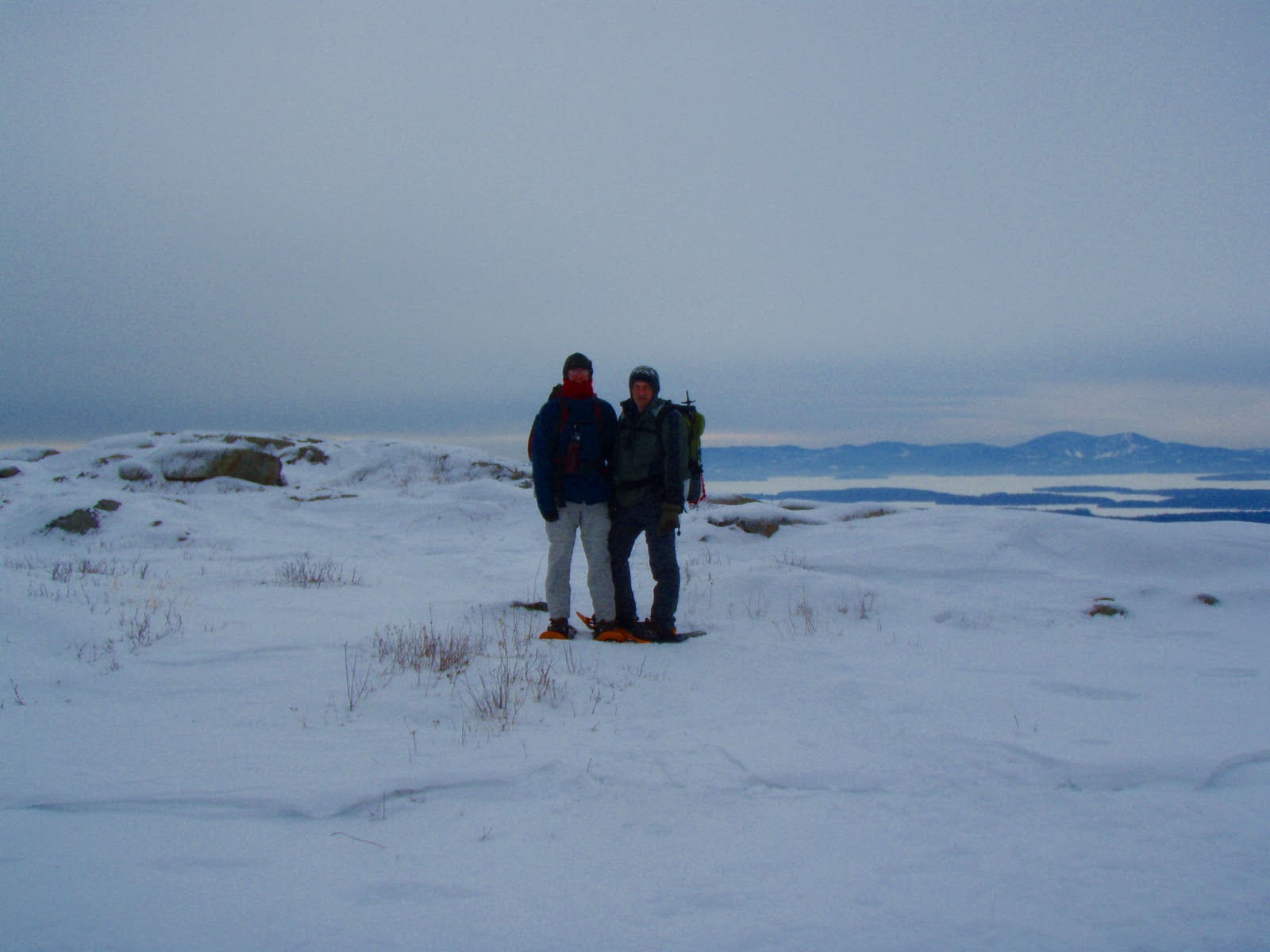
We reached the Bald Knob summit at 11:15am. The wind was blowing steady here making the low 20's feel like the low teens. The view was wonderful. The clouded sky's made pictures better then if the sun was shining which would have caused solar glare off the snow and there was a wonderful glow behind the Belknap range beyond Lake Winnipesaukee. Some quick pics and we were headed back down out of the cold. Scott took the usual lead down and boy did we drop down the trail with haste! There were a few near falls for both of us and Scott nearly pulling his back out on one particular slip. We had some fun following the two ski paths that weaved back and forth on and off the hiking trail. We arrived back at the snow mobile trail. A scary moment of the machines coming just as we got on the sharp corner of the road then onto the Shannon Brook trail for an uphill walk back to the truck. Finishing time was 12:30pm.

This trip was just enough for us. Plenty of elevation, about 5 miles. Temps ranged in the mid to upper 20's with a wind chill at the knob. A beautiful area that I can't wait to explore over the next year! And I can't wait for a Spring hike on the beautiful brook trail when the water is gushing over those falls!