Monday, November 22, 2010

Mt. Major/Straightback/Straightback North 11/21/10

"A Major Figure 8" (pictures)

Difficulty: Moderate (steep and rough especially on ledges)


Directions: From Alton, NH take Rt. 11 West and follow it for about 6 miles. Trail head parking lot is on the left (blue sign)
Report: Once again Scott and I didn't make it to the White Mountains :'( The forecast was for bitter temperatures and a breeze, and with some things do to at home we decided to stay close by yet again. Well it turned out to still be a great day and wonderful weather! We decided on Mt. Major and figured we'd attempt to tramp some new trails. And of course I had to tell the mountain "HI" for my parents who moved to Georgia this past fall and whom are really missing "their" mountain!
We arrived at the relatively quite parking lot, maybe 8 vehicles including the red van of never-miss-a-day-on-major Art! We began at 9:30am and I decided to take the Boulder trail on the Left side of the parking lot (orange blaze). I had come down this way two or three times with my mom in the winter and was curious as to how it was on dry ground. We made our way past some boulders and stopping to put our necks and heavier hats on. The ground here-and-there was thin curly ice crystals topped with dry mud. Following the logging road we soon came to a trail off the right side. This is what I remember coming down but the blazes continued down the road. I was confused at first but realized that what I thought was the boulder trail is apparently one of the many unmarked trails on this peak.

Continuing on up a hill and through birch and beach tree glades then into a red pine glade. I love red pines!! Then we saw why this trail is called boulder trail! A huge boulder field lay ahead of us. No matter how many boulder fields I've been at it's always very cool. Midway up we began to noticed charred trees and brush. Apparently this was the area where the last forest fire occurred this past summer. Views began to peak through the trees of Alton Bay and Lake Winnipesaukee. The trail became steeper as it climbed up to and around a large ledge.

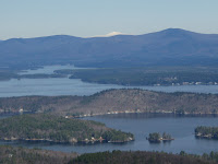
On top of the ledge views open up even more and a wonderful half mile hike up this East ridge to the summit of Mt. Major. This side of the mountain was spectacular and I can't believe after 20 or so years of hiking here I had never ventured off the main trail! Ice now appeared on the trail and ledges here-and-there. The summit reached (1786') at 11:00am we were greeted by Mt. Washington glowing almost an orange color as the sun shined off it's white peak across the lake. The summit area was quite and empty, visibility was excellent! I pulled my phone out and sent a pic to my mother. The cold set in quick upon stopping so a short breather here then off to find the Quarry trail.

Down the red/blue blazed trail to the Quarry Spur junction, which we took. New territory for us now! The trail drops down to a col. through a logged area. Then climbs up to a ledgy area of Straightback North summit. We banged a right now on Quarry Trail up to the peaks wooded summit (1910'). We continued down the other side to nab some photo's of Gunstock with it's snow guns blasting white stuff on the mountain. The trail soon drops steeply and it was decided we'd head back towards Straightback instead. Once back to the North summit ledge views of Mt. Major were wonderful and unique from here. A very worthwhile side trip!

Down this small ridge to the ledges below Straightback we stopped here to relax a bit and have a lunch break at 12:30pm. The sun was glimmering off the lakes or ponds to our East. Once done with lunch we packed up and headed up over Straightback's summit (1880') and back down to the Brook Trail (yellow blaze). We followed this trail down, well, Scott did. Once we got to visibility of the brook I took off down the banking and through the woods to snap photo's! Back on the Mt. Major trail (blue blaze) we began to pass many people headed up. We finished our figure 8 loop at 2:00pm. Total mileage about 5.5 miles.

Sunday, November 21, 2010

Stonehouse Pond 11/20/10

"Photography in Stone" (pictures)

YES, I was back at Stonehouse Pond AGAIN! I can't help it, I love it there! Actually I had met a fellow photographer on Flickr who lives in Farmington. He'd not been to this Pond before so we planned on meeting up Saturday morning to shoot some photo's. The road is now gated so we had to walk down to the trail start. One other guy was down here also taking some photo's. We made the loop Clockwise, taking our time talking and snapping some pictures. At the top of the ledge we spent some time up here taking in the view and more pictures. Two crows across the pond were making a lot of noise chasing off a hawk, otherwise it was very quite, a slight breeze and sunny. We slowly made our way down the other side stopping here and there including a short whack to the beaver homes on the West side of the pond. Then back to the road. It was here I noticed an unusual orange colored pine tree. A closer look and the outer bark had been stripped top to bottom, the entire tree. It was very odd and unusual. We both agreed it had to be a wood pecker, but we still weren't sure. The bark pieces were in a pile at the bottom in 4 inch length pieces. Strange!

Monday, November 15, 2010

Stonehouse Pond 11/14/10

"Again!?" (pictures)

Yes, again! Stonehouse Pond, such a beautiful pond loop. Another weekend of not getting up North to the White Mountains we did some window shopping in Portsmouth. Mainly a stop at EMS to get a new hiking long sleeve shirt and to stop at the various sports stores to look at snow shoes. I am NOT going another winter without them!! The plan was to find Adam's Point or some other conservation/forest area on Great Bay. But seeing how the coast was cloudy and much cooler than the inland I headed to Lee and up "Antique Alley". After stopping at our favorite antique/collectible store I headed for Stonehouse Pond.

We pulled onto Stonehouse Pond road which has a new street sign, so easier to spot for those who don't know where it is. There was one car in the lot, a man and son were just starting out the loop clockwise. We decided to go the opposite direction having carefully followed the not-so-visible trail on this side of the lake last time. This time however someone had marked the trail with orange tape, so following it was no problem this time around.

Once past some pretty and massive ledges we climbed to the top of the main ledge that overlooks the pond and area hills. Such a lovely spot. One could sit here all day and just take in the serenity. Coming back down the other steep side, careful not to slip down the banking on the leaves we passed the two we saw at the start. A quick hello and we continued on our way. This side follows the pond closely and the rock ledge, reflections and colors made for some very nice scenery and pictures. The small trip ended with the glimpse of fish (salmon or trout) gathered near the dam. Must have been recently stocked. That raps up another trip report on this little slice o heaven :)

Saturday, November 13, 2010

Gonic Trails

"Waste, Woods and Water" (pictures)

Such a beautiful day today I just had to get out and do something! It was already getting late in the afternoon and I had to go to Rochester to do some grocery shopping. The park over by Waste Management came to mind. A hiking area that I have passed thousands of times but had not bothered to stop at yet. I made the short trip to Spalding Turnpike, headed South on Rt. 125 into Gonic and after passing the blue Isinglass Mt. Hiking sign I took a left onto Rochester Neck Road. The parking lot was just over the hill on the right, you can't miss it! Parking was 1/2 full much to my surprise. I checked the map and headed off, deciding to take the blue blazed Locke's trail upper section.

A gentle walk down a logging road through a pine forest. After connecting to the lower loop I kept to the right downhill to the river,  now blazed in Yellow. Here a sign was on a tree addressing Anglers. There was a granite bridge foundation and a rather pretty Isinglass River. I continued on the river trail (Luanne's Lane) to a banking with a large carved out ledge on the left. And to the right an old Mill foundation and some pretty falls. A man was fishing here and there were a few other people hangin' out.

I continued on calling Scott who was just getting out of work at 2:30 telling him to meet me here. I planned on taking the Red blazed Watson's Way back to the parking lot. Passing by another fisher and the blazes changed to yellow and red. Then back to yellow. Confused I continued on for a ways before I began to wonder why I wasn't seeing any people and why I hadn't seen the red trail yet. I pulled my camera out and checked the picture of the trail map. It appeared I had missed the red trail. Back I went, jogging at times until I came back to the yellow/red blazes. I searched for the red trail but was unable to find it!

So, confused I went off jogging all the way back up the river and back down the Blue trail to meet Scott in the parking lot. I explained to Scott the very confusing trail web. Instead of giving each trail it's own color they double blazed where trails coincide, with each trails color. Sounds simple but it really confused me! Ah well. This time I took the red/blue blazed trail keeping right as it finally became all red. Then found where it meets the yellow river trail. Back again up the river then followed yellow back around to the parking lot.

Total mileage for me was like 4 miles. Nice easy trails if you don't mind a horrid waste smell every now and then. And somewhat confusing trail system. The Red and Blue trail loops have secondary names "forestry Tour" and "Local History" names with numbered sites but no interpretive signs explaining the site. So a little confused on what these site numbers are? I'll have to do some online research I guess. And the Gold trail says it's a 7 round trip but only shows 2 miles worth on the map. So I am guessing it continues on past where I had made it. Perhaps to Isinglass mountain or something. I dunno! More exploring I will have to do. 

Thursday, November 11, 2010

Abenaki Tower 11/7/10

"A Quicky Side Trip"

On our way back from Castle in the Clouds I stopped at a sign I had seen earlier off Rt. 109 for Abenaki Tower. I was curious and had to check it out! A short, easy walk up a gated logging road brings you to a small clearing where a observation tower stands. The tower itself is in really good condition, just covered in graffitti, apparently a popular hang out spot! The view is pretty good across to Lake Winnipesaukee and over to Castle in the Clouds. A neat
little spot that I had passed many times and never new of it's existence!

The plaque on the entrance sign reads: "This tower is maintained voluntarily by local residents who desire to share it's view and beauty with friends and visitors ...... Abenaki Tower Association, Melvin Village, NH 03850.


According to firelookout.org it was built around 1929 and rebuilt 1979.
It's original use was to spot aircraft during World War II and was occasional used as a fire tower. Now it serves as an observation tower for any who wish to visit.

Tuesday, November 9, 2010

Castle in the Clouds Conservation Area 11/7/10

"This is NH at it's Best!" (pictures)

With an array of weekends that brought Scott and I more work than usual we had not made our way into the White Mountains in some time. And we were itching to get back! Well we didn't quite make it again but boy were we in for a treat! The weather was "iffy" and we again decided to stick close to home. After contemplating on possible candidates for our hike Scott said suddenly "how about Castle in the Clouds?" He has mentioned this over and again all year and I always shrugged it off as probably too crowded and probably not much for trail options or views. WELL, was I WRONG!! We arrived at the access road to find the Castle closed for the season. Hmmmm, now what? The sign pointed to the Castle Springs Road and Castle Springs Park. Sounds like a possible entry point..... Up the road we went and found a hiker parking area and the Castle in the Clouds Conservation Area. 5,380 acres of mountains, ledgy views, farm land, ponds, waterfalls and oh, a castle!

The trail map was iced over and the small one on the side of the kiosk was difficult to read. So we would just be going with the flow, let the trails take us wherever. We began the brisk morning by walking up the road to the castle. What a beauty! And a view to match, fog lifting off Lake Winnipesaukee with mountains beyond and all around us. I saw a large rock knob in the distance towards Mt. Shaw and I really hoped we could find a trail to it!

Back down to the road we took a turn down a logging road marked by white diamonds and a kiosk that read Brook Walk. I thought, eh, just the usual babbling brook, no biggie! The trail follows the road a little distance then breaks off to the brook. A beautiful ledgy cascade greeted us. And so it would be down this entire trail, complete with interpretive signs at each stop. So many cascades, a beautiful 50 foot waterfall and a flume/waterfall 40 ft. high with a boardwalk that brings you close to the foot of this spectacular water feature! It was like being out west in Yellow Stone or in the Amazon. Wonderful!! The trail now crosses the brook and loops back making a steep climb up the banking. Then it meets the Shannon Brook trail. Brook Walk was .4 miles I believe and a bit rough. Certainly not for the unfit tourist! Careful with kids!!

A short ways on Shannon Brook Trail which is another logging road we soon arrived at Bald Knob Cutoff. This got me excited! One mile up this rough, granite covered trail passing over several small partially wooded knobs. You pass a sign at one point noting an unusual and rare rock formation called Columnar Jointing. It was pretty interesting! Especially for the rock lover I am! We then came to Bald Knob Trail which appeared to be a carriage road. A short distance you pass by granite ledge to your left and a slight drop off to your right and views begin to open up. Then you arrive atop the granite knob at 1,801 feet. Views again to Lake Winnipesaukee and the Belknap range. Down to Castle in the Clouds sitting atop Lee Mountain, and views of the conservations mountains including Turtleback directly behind us.

Satisfied with our climb, the weather getting colder and cloudier as the morning rolled by, we called it a day and decided to head back to the parking lot. We returned the way we came, stopping again at the columnar jointing rock to investigate it further. Than down to Shannon Brook trail which we took back to Shannon Pond near the parks entrance, passing first an area with views back up to the castle. It was at the Shannon Brook kiosk that we found a more suitable map of the area. More to add to the to-do list! And believe me, We'll be back!! NH at it's best. Historic structures, cascades and waterfalls, rough trails, granite ledges, lake Winnipesaukee and mountain views and wonderful trails (well marked here might I add)! Total trail mileage round trip was almost 5 miles I believe. (pictures)


The Map


Monday, November 8, 2010

Mt. Major 11/2/10

"Playing Like Kids on Major" (pictures)

Difficulty: Moderate (steep and rough especially on ledges)


Directions: From Alton, NH take Rt. 11 West and follow it for about 6 miles. Trail head parking lot is on the left (blue sign)
Report: The original plan for Tuesday with my brother and his son Jonathan to hike Mt. Agamenticus in York, ME was shot down that morning when my brother told me that he would not have his son today. I was hoping to get JJ up on his second mountain but it would have to wait! My bro still wanted to hike so we decided he would come my way and we'd do Mt. Major. It was a beautiful day. A little cool but very nice. We made our way quickly up the Main trail passing several people along the way. We reached the ledges which had some ice here and there. A small break on the ledges, I sent a picture to my mom in Georgia who hiked this every day was missing it. Onward up the icy ledges we reached the summit 45 minutes from our start time. We spent more time up here than usual. Jeremy had not been up here in a long time and the vivibilty today was amazing. Mt. Washington as usual this time of year showing off a bright white over the Ossippee range.


After exploring the entire crown of the summit we made our way down, jumping rocks and playing around like we were kids again. I found the unmarked trail I used to take in the winter which connects from the Main trail level road area to the first ledge. Down we went running through the forest and leaf covered trail. I had to stop a few times to figure out which way the trail went, then off we went again. I was happy to make it back to the main trail knowing that my mind is still sharp enough to remember this obscure route I used to travel! Once down to the boulder section I decided to explore this area more in depth. I have never really got deep in the woods here and there is a huge expanse of boulder all along the trail. Again we jumped up, over, around, through and inside the boulders like we were kids again (and I was reminded the next morning that I was not, I was SORE!!). We finally made it back to the truck, all-in-all I think we were on the mountain 2.5 hours or so! Great afternoon and always enjoy having my Bro along with me :) (pictures)

Friday, November 5, 2010

NEW HikeTheSummits STORE!!!

Click HERE to be directed to my store! Currently putting up 2011 Calendars and more to come!