Showing posts with label barrington. Show all posts

Monday, March 28, 2011

Goodwill Conservation Area 3/26/11

"Mossicles" (pictures)

Directions: Barrington, NH head West on Rt. 9 past Calef's Country Store and the Pine Grove Cemetery. You will pass Province Rd. on the left and on the corner to the left is the pine tree hidden entrance to the parking area. The sign is set back from the road and you will see the marsh.


Yet another cold, windy weekend was really getting on our nerves! The forecast for below average temperatures hovering around 30 with strong winds had us bummed out Friday night. So we decided on just waking up whenever and hiking something small and close by. We headed out in the morning, winter jackets in hand...blah! I was undecided on heading to nearby Blue Job Mt., Little Niagra Falls or Stonehouse Pond. Instead I set my sights on something I visited back in October 2010, Goodwill Conservation Area. Scott had not yet been here and it was raining last I visited. It was an easy logging road walk and sheltered somewhat from the winds. So this was a good  choice!

The parking lot was still partially plowed in, but nothing four-wheel-drive couldn't handle! We threw our jackets on already cold just from stepping out of the truck! The time was 11am. The marsh was still frozen over as we made our way over the small bridge over the outlet stream. Then right at the fork to follow the trail along the marsh. The trail makes a small loop, but Scott noticed a barely visible trail at the loops corner that continues to follow the marsh! This trail basically follows the bank along the shore of the marsh until it joins the main logging road (left at the before mentioned fork).

From here we followed the road beyond the marsh and slightly uphill past some small quarry sites. A lone track of fresh footprints were noticed in the snow patches in one direction. We were apparently not along in these woods! Sure enough a man came into view headed back out. He looked surprised to see anyone here and was happy to tell us the logging road goes all the way over to Beauty Hill Rd. We soon reached the ledges rising on either side of us sporting green moss, lichen and melting ice. It was very pretty. You can take a left before the ledge and follow a trail that breaks left to an open area with a tree top view across the valley. Back on the ledge a fire pit was left with a broken liquor bottle and beer cans. Once again I should have brought a trash bag with me. It's just so upsetting to always have to take a trash bag with you to pick up after those who don't respect nature and the law for that matter!

 We now followed the mans tracks trying to figure out which direction he went. Scott took off hot on his trail as I slacked behind still at the ledge taking pictures of icicles poking out from the moss which I call "Mossicles" :p>LOL! I caught up and we walked the road which made a loop to another part of the marsh where we explored the woods and shore in this area. Then the road loops back to the ledge again. Perfect! We now made our way back towards the parking lot making note of some of the pretty rocks laying around near the quarry areas. We finished  this fine figure eight loop at 12pm. An hour well spent! This is a family friendly walk, easy for all ages! Views are not what this area boasts of. But the marsh, forest and ledges are pretty and in the summer your sure to see a wood chuck, otter or beaver!

Friday, January 14, 2011

Stonehouse Pond 1/13/11

"It's a Girl!" (pictures)

I had hoped to get out and do some snowshoeing today after all the fluffy white snow we got. I've yet to try out my first pair of snowshoes and I was getting antsy! I was feeling a bit lazy, but I kept looking out the window at all the snow and crisp blue sky and figured, awe heck, give in to the itch! So I threw my winter clothing and some snacks in my little pack, grabbed the shoes and threw them in my truck. Off I went to Stonehouse Pond in Barrington!

The Stonehouse pond road was not plowed out so I drove by and made a u-turn. There was no room on the side of the road and I wasn't sure what to do. Directly across the street there were two large areas plowed out at the end of someones driveway. I wondered if this was parking for those accessing the pond? I parked there anyway, who would take the time to plow that much space for a driveway, I thought.

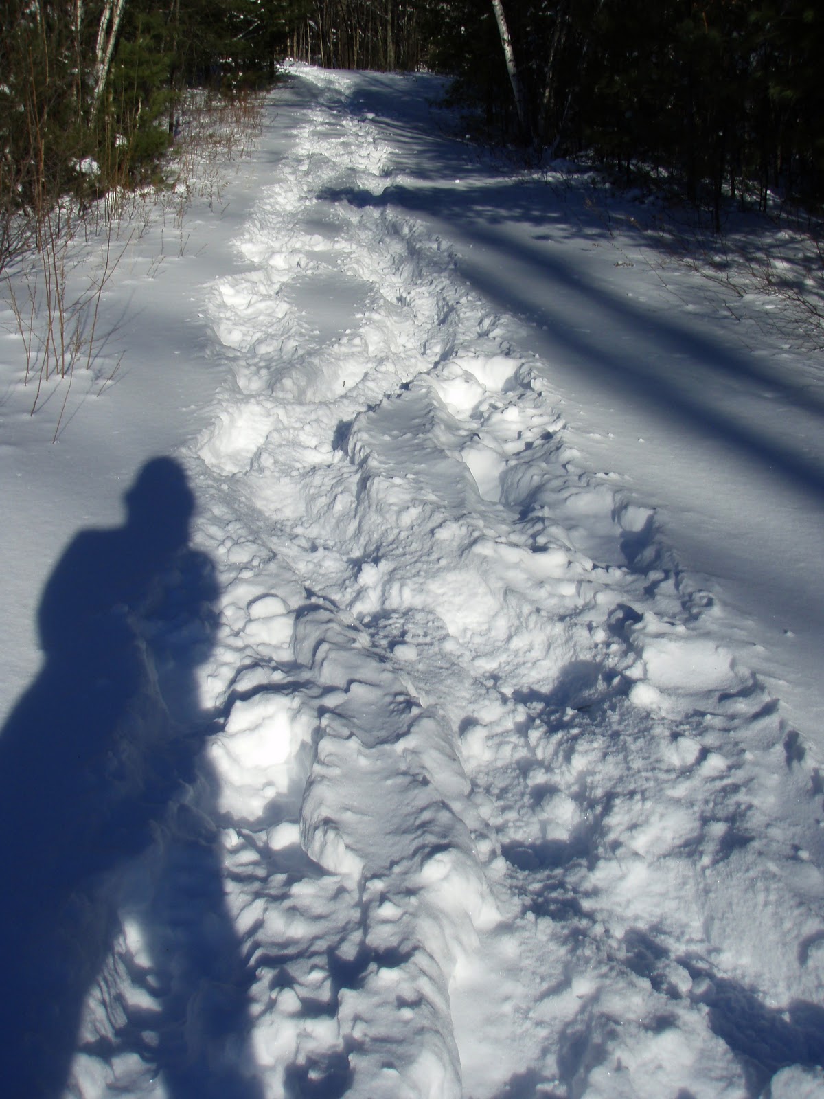
I parked at 1:30pm and tied my boots and threw on the Tubbs. The road had seen two hikers already but was still very unbroken. I walked the half mile to the pond easily, passing the snow mobile trail. The pond was covered in snow, the ledges streaked with white. The sun hovered directly above the ledges making for some crappy pictures. The other hikers trails stopped here at the ponds edge. Breaking the trail would be up to me! I walked down the banking and below the small dam then made my way up around the corner to the rocky outlook across the pond to the ledges.

Then I made a slippery walk across the steep banking and down along side the pond. Now and then I would snag a rock nearly causing me to fall over. And the tree logs across the trail, which are a welcome challenge to climb over in the summer, were now a nuisance! I made it to the ledge and began the steep climb up. It was tough, especially towards the top where it gets very steep and you have to climb over another fallen tree, ugh! But I made it without a scratch, walking out on top of the ledge at 2pm. What a sight!

The sun was casting a wonderful tree line shadow on the lake and all was still and quite. Except for the occasional hum of ski mobiles going by down on the trail. And, "bling", a text message. Ah technology! It was my sister, "it's a girl!" What a message to get as I am relaxing on top of a ledge! Congrats Sis! I downed a coconut water and thought about which way to return. I could continue the loop around the lake, but that way is a little more difficult, overgrown in spots and somewhat hard to follow. So I just decided to return the way I came, and at least that way I could break the trail out some more.

I began the climb down the steep section, well, more like sliding and jogging. I was sure I would fall face first into the snowy slope. Luckily I stayed upright! I made a quick return around the lake, made a few more peaks at the pond and ledge and headed back down the road. I was happy to see my truck hadn't been towed! I finished at about 2:45. I had been so excited to hike this in the winter and it was very enjoyable and just enough a challenge for a week day!
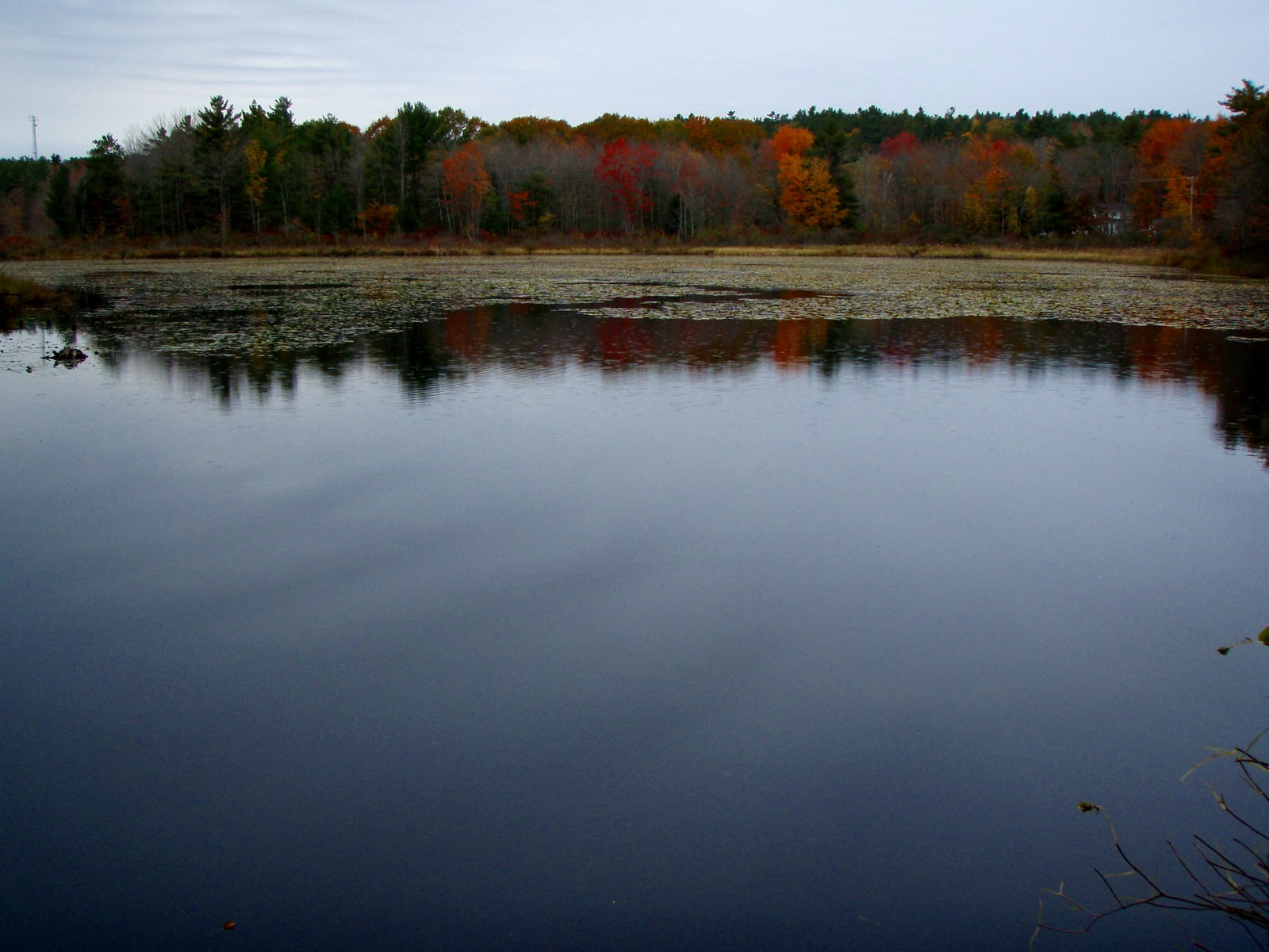
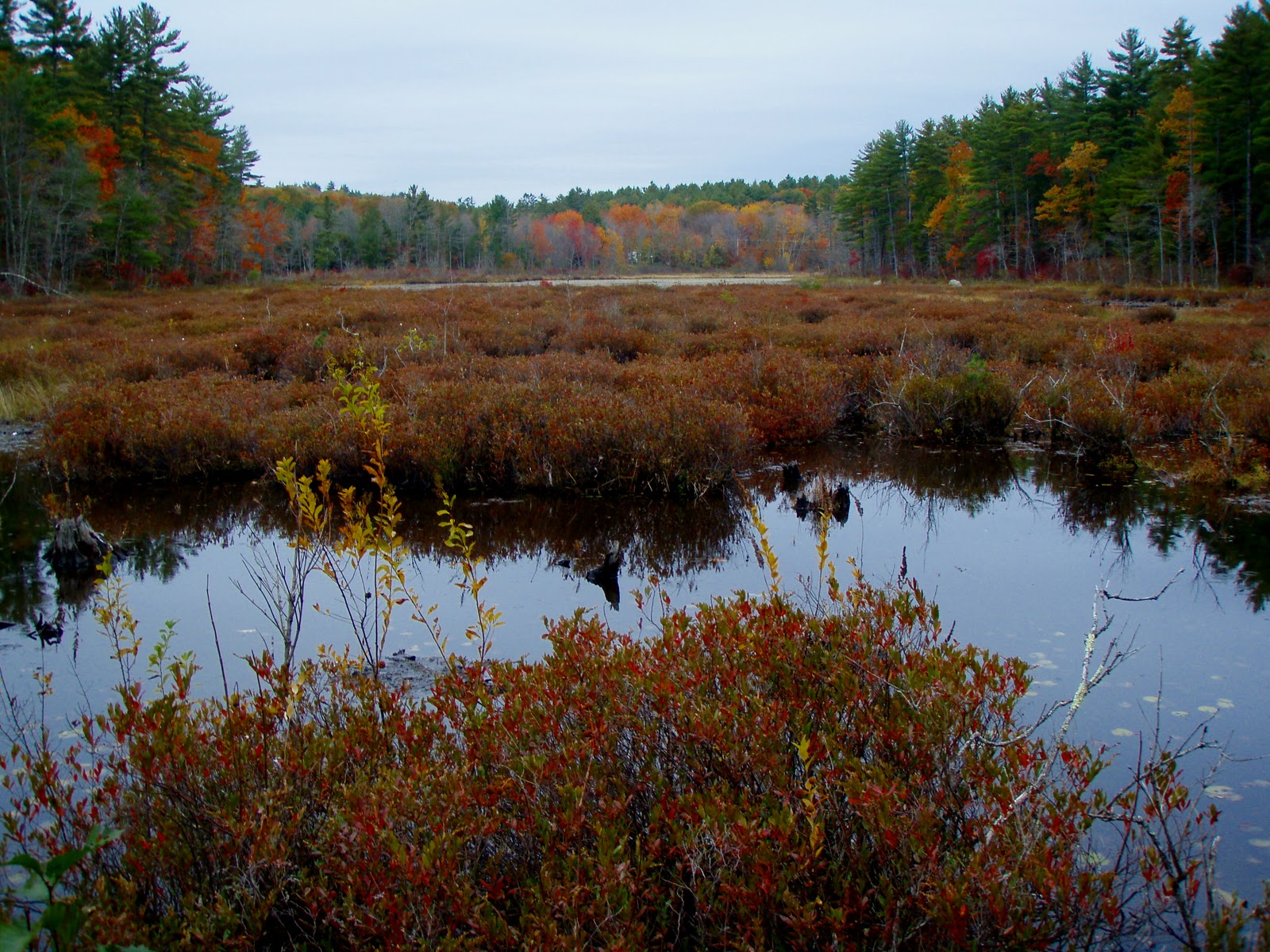
Sunday, November 21, 2010

Stonehouse Pond 11/20/10

"Photography in Stone" (pictures)

YES, I was back at Stonehouse Pond AGAIN! I can't help it, I love it there! Actually I had met a fellow photographer on Flickr who lives in Farmington. He'd not been to this Pond before so we planned on meeting up Saturday morning to shoot some photo's. The road is now gated so we had to walk down to the trail start. One other guy was down here also taking some photo's. We made the loop Clockwise, taking our time talking and snapping some pictures. At the top of the ledge we spent some time up here taking in the view and more pictures. Two crows across the pond were making a lot of noise chasing off a hawk, otherwise it was very quite, a slight breeze and sunny. We slowly made our way down the other side stopping here and there including a short whack to the beaver homes on the West side of the pond. Then back to the road. It was here I noticed an unusual orange colored pine tree. A closer look and the outer bark had been stripped top to bottom, the entire tree. It was very odd and unusual. We both agreed it had to be a wood pecker, but we still weren't sure. The bark pieces were in a pile at the bottom in 4 inch length pieces. Strange!

Monday, November 15, 2010

Stonehouse Pond 11/14/10

"Again!?" (pictures)

Yes, again! Stonehouse Pond, such a beautiful pond loop. Another weekend of not getting up North to the White Mountains we did some window shopping in Portsmouth. Mainly a stop at EMS to get a new hiking long sleeve shirt and to stop at the various sports stores to look at snow shoes. I am NOT going another winter without them!! The plan was to find Adam's Point or some other conservation/forest area on Great Bay. But seeing how the coast was cloudy and much cooler than the inland I headed to Lee and up "Antique Alley". After stopping at our favorite antique/collectible store I headed for Stonehouse Pond.

We pulled onto Stonehouse Pond road which has a new street sign, so easier to spot for those who don't know where it is. There was one car in the lot, a man and son were just starting out the loop clockwise. We decided to go the opposite direction having carefully followed the not-so-visible trail on this side of the lake last time. This time however someone had marked the trail with orange tape, so following it was no problem this time around.

Once past some pretty and massive ledges we climbed to the top of the main ledge that overlooks the pond and area hills. Such a lovely spot. One could sit here all day and just take in the serenity. Coming back down the other steep side, careful not to slip down the banking on the leaves we passed the two we saw at the start. A quick hello and we continued on our way. This side follows the pond closely and the rock ledge, reflections and colors made for some very nice scenery and pictures. The small trip ended with the glimpse of fish (salmon or trout) gathered near the dam. Must have been recently stocked. That raps up another trip report on this little slice o heaven :)

Monday, October 25, 2010

Goodwill Conservation Area 10/24/10

"A Barrington Find on a Yucky Day" (pictures)

OK, so it wasn't THAT yucky. Scott had to work Saturday and of course that turned out to be the nice day of the weekend. With rain showers forecasted for Sunday afternoon I figured we'd once again stay close to home and hike Mt. Major or something. Well, between rising late and having too much to do for the day we never made it anywhere. I had some work to do in Dover and Barrington so I decided to snap some pictures of the areas old buildings and cemetery's. It was after I left Barrington's Pine Grove Cemetery that I noticed a sign as I "wizzed" by, "Goodwill Conservation Area". And as you might guess I turned around! There is a small parking lot in the trees. This area was protected in December 2007 and is 156 acres!

You are immediately greeted by a pond, Richardson Pond I believe is it's name. The trail begins by climbing over a gated bridge (why there is no pedestrian throughway I don't know!?) and you find a path to the right and a logging road to your left. I took a right as the path followed the pond. After a short ways the trail makes a tiny loop and you end back at the start.

Now I headed up the logging road. It's starts off at a gentle ascent about 100 feet in elevation. I figured I'd run into someone as there was a vehicle parked in the lot. Sure enough I came across a lady walking her dog. I asked about the trails and she was very nice in giving some info. I continued on over another hill until I came to a sign that read "Ledges Trail", and some other ski mobile "mumbo jumbo". Apparently this is part of a ski mobile trail network in the winter. You now pass several ledges in the trees and as you make your way down the hill a large ledge on the left beckoned me. I climbed up to the top of it to find a trail. I followed it to a beaten path to another open ledge, then decided to go back to the main trail. I walked down to the end of the ledge to a fork in the road and a diamond sign. The lady had told me this was not a loop. I wasn't sure which way to go and since it was sprinkling I decided to head back before it got really wet as I wasn't dressed to be out in the woods!

So back I headed, climbing to the top of another ledge finding another semi-open rock slab. Then back down the trail hoping the rain would hold off. I caught a glimpse of something red in the dirt road, and spun around to investigate. It was a red-walled tire that read "US Royal", which upon some research are tires that were used in the 1960's and years prior. Neat find, I thought! I made a stop at the marsh I passed earlier, bushwacking to it's shore for a clear picture. Back on the road I did a tick check and got back to the pond for more pictures before heading home. Distance was about a mile (1 hour round trip) with the pond loop and logging road. I will have to investigate further where the other roads go to on a better day. (pictures)

Friday, July 30, 2010

Stone House Pond 7/29/10

See the pics HERE

Upon reading an article about Stone House Pond in Barrington, NH and seeing the picture of the large chunk of granite that sits on the pond's bank, I was eager to check it out. I had my monthly lunch with my Grandmother in Epsom and decided to take the US 202/NH 9 route home. This would bring me right by there! I passed the road once, noting an unmarked dirt road next to a white house. Upon back tracking I noticed a fallin' apart wooden sign that read Stone House Pond. Turned around again and headed down this road. You immediately pass an open gate and down a pleasant woods road reaching the parking lot along some large boulders. There is a NH Fish and Game sign here that only gives boat launching directions and nothing else.

I walked around the large chunk of granite and to the lakes shore and looking across could see the magnificent tower of ledge. There was a kayaker fishing off to the Western side of the pond. The trail was easily seen to the left (clock-wise)across the lakes outlet stream. The only method of crossing is by a difficult rock hop or a tricky jump across the small dam structure. The trail was surprisingly well worn and easy to follow. It curves around the lake shore to another slab of rock with a wonderful view directly across the lake to the ledge.

Continuing on the trail breaks away from the pond and becomes somewhat steep and loose as it climbs the banking. It then drops back down to the shore and follows it rather closely. It was somewhere on or after the steep section that a well defined trail broke left. I almost took this thinking it might be the way to the ledge. I opted to stay right which turned out to be the correct way. I am not sure where the other "trail" went, perhaps to a boulder or something? I didn't see it connect back to the main trail either further down, so something I will have to explore next time.

Back to the main trail now, again you follow the shoreline until you reach the bottom of the ledge. You then climb along side it up a steep, loose trail and around the back and easily up over to the top of the Stone House Ledge, about 150 ft. Such an amazing feeling for such little effort. You stand majestically over the pond, the ledge dropping steeply in front of you. You can see a few area hills, Blue Job and I'm guessing Parker Mt. Also there is a cell tower "disguised" as a tree, but looks more like a cruddy old artificial Christmas tree! It's the thought that counts I guess! Oh, and I was surprised to see Jack pine's atop this area too.

I went back down the way I came since the trail around the Western side of the lake was barely visible and I had read that it could be very wet. I easily made my way back stopping to capture a picture of a butterfly and a large "wood" moth who showed off a pretty orange under his wings when flying from tree to tree. Over all I believe this was half a mile with 160 ft. elevation gain round trip. Nestled discretely around the larger areas of Pawtuckaway State Park, Nippo Lake and Scrutton Pond it would appear this pond stays rather quite. Not a single speck of litter was to be found, a little graffiti on the rocks looked faded and despite the well worn trail, the top of the ledge looked to have been grown in where beaten paths once existed. Thank you to the Trust for Public Land for purchasing this land and making it a permanently protected area!!

See the pics HERE

Monday, May 3, 2010

Stone House Pond

Scott found this article in Fosters which certainly caught my attention. Stone House Pond (which is described in the Southern NH hiking trail book) is now permanently protected. I was not aware of this beautiful pond and adjacent rock ledge. I plan on taking a hike here soon and will share a report and pics. View the article and pics HERE