Showing posts with label hiking. Show all posts

Tuesday, August 16, 2011

Mt. Garfield 8/13/11

"Number 26 and Two to Go!" (pictures)

The weather was looking good for Saturday so in the morning we headed for Garfield. I had only done this peak once during one of my fathers Youth Group hikes in 1998. So this was like hiking it for the first time as I didn't remember much. The Galehead Road was fitted with brand new bridges, they even smelled new! The parking lot had a van and a couple cars with fog on the windows, indicating they were over-nighters at the hut. We got a really early start at 7:45am, with a couple people starting right behind us.

The trail climbs a banking and meanders through a pine forest. I spotted a couple Downy Rattlesnake Orchids along the trail here. We heard a group of girls singing through the trees and soon a girl scout or girls group came marching down the trail of about a dozen. Most had smiles on there faces and it looked like they had a great time! The group leader at the rear of the line apologized for there "intrusion" and once past us we could hear her yelling up at the front of the line that they had best stop for hikers coming up the trail! 

We were passed by the others that started out behind us and we soon left the pine forest and into a wet section of forest. The trail adopter has really done a lot of work in this section building all sorts of water bridges/platforms and foot bridges. Great job! The trail now climbs at a moderate grade following a fire road. Remnants of the power line poles are seen off the trail if you look hard enough. Mushrooms were out and as usual we were stopping constantly to snap pictures of them! Once the trail began a steeper climb and mushrooms became less, we picked up our pace.

The trail makes some long switchbacks and Indian Pipe were flowering all over the place on the upper sections. White and yellow Aster were also flowering along the trail. After negotiating the switchbacks we made one steep climb up next to an interesting rock formation. We finally reached the trail junction with Garfield Ridge trail after what seemed like a long and rather boring climb of 4.8 miles. Now, as the trail book indicated, the trail makes a sudden steep climb up to the rock spire summit of Garfield.

There was almost a dozen hikers up top. The rather unfortunate thing about this summit is that the cement foundation walls are left at the top. This takes up too much room and is an eye-sore in our opinion. It should have been completely removed! We climbed down the ledges that drop in layers on the South side. We found a nice ledge to eat lunch on away from the crowd. Arrival time was 11:15. Wow! a half hour quicker than the book time!!

We took our time eating our lunch and enjoying the beautiful day. The humidity was causing hazy conditions so views weren't the greatest. The Twins and Franconia range were in view, The Franconia's in particular were impressive with the towering summits of Lafayette and Lincoln followed by the pyramid spires of Liberty and Flume. Owls Head in the middle of the valley floor was also impressive from this vantage point above. The Bonds were barely visible through the haze as was Carrigain and the Sandwich Range.

Our lunch consumed and our bodies rested we packed up and headed back down. We passed a lot of people making there way up the trail. So glad we have been making the early starts and beating the crowds! When we arrived at the parking lot 30 or so cars were parked up and down the road! Number 26 of the four thousand footers for Scott. Two to go to catch up to me! Then we can finish the rest at the same time :)

Monday, July 18, 2011

Mt. Cannon 7/16/11

"A Switch-backin', Pine Bramble" (pictures)

With beautiful weather on tap for the weekend we had our eyes set on a 4000 footer! We planned on doing a peak to get Scott caught up to me. Thus the options were Garfield, Tecumseh, Cannon and Eisenhower. Tecumseh is an easy hike I'd like to save for winter so that one was out. Eisenhower I feared would be very busy as it generally is in the summer. Not to mention the trails to the summit aren't the most exciting. Next on the list, Cannon. Again a very busy mountain particularly with the gondola. But, one that I hadn't been to in over 10 years and it had several trail options. Garfield is one I have been really wanting to hike too. I haven't been on this mountain in close to 15 years! We planned on getting up really early so I waited to see how early we managed to head out, how we felt and how the weather was in the morning to determine the mountain.

We awoke early as planned and headed out the door feeling ready and excited for a great day of hiking! Cannon was our pick for the day. Perhaps with the early start time and with the races going on in Loudon perhaps it would be on the quite side. We arrived at the trail head and got front row parking at the hiker parking lot! Awesome! I mentioned to Scott this lot will be overflowing out to the road when we get back! We got our boots on trail at 7:30am. The trail cuts through the campground, people were just getting up and getting there breakfast going and what-not. Once past this the trail climbs a wide gravel path up to the junction for Lonesome Lake trail. We took a right here on Hi-Cannon Trail.

The trail now climbs moderately up eroded switchbacks, passing various boulders. Many large/mature birch trees grace this hillside. Scott spotted a large toad in the sandy trail and Northern Wood Sorrel was blooming here-and-there. We stopped at a fallen down tree that had it's entire root system pulled halfway out of the ground looking like bars in a prison. Mushrooms were plentiful and the day was starting off very pleasant!

Past the Dodge Cutoff the trail climbs more steeply and the trail seems to become less eroded. It would appear hikers stick to the trails to Lonesome Lake and probably ascend Cannon via Lonesome Lake trail. After a couple large switchbacks you then must climb a rather rickety ladder along-side a steep ledge face. We've been on plenty of ladders in the Whites, many steeper and higher than this one, but something about it leaning to one side and the steps looking a little worn made this climb a little creepy!

Continuing on the trail follows the crown of the ridge with views across the notch to the Lafayette Range. Then you arrive at the first of several fine ledges. We sat down on this ledge and took a nice long break enjoying this fine day and beautiful view. From the left you could see the Eagle Cliffs, the impressive Lafayette/Lincoln peaks and down to Mt. Flume. The view continues across the notch and around to Lonesome Lake. After some time we were joined by a young couple and we packed up and got back to the trail. The pine trees along this section had grown in and were brushing up and poking at us as we passed through. We checked out two other ledges along the way, with the added view to the Kinsman Mountains.

The trail moderates some as you pass through and over several ledges and rock formations.We soon arrived on the Kinsman Ridge trail and made the easy climb to the observation tower on Cannon's summit. Number 25 for Scott, still 28 for me! The summit was still surprisingly quite, but it was only 10:30am! Perfect time to be up here! We took our break and took in the view. Not all that better of a view than from the ledges, but a 360 degree view none-the-less. We then headed down and explored the rim trail a bit. We discussed hiking down to the profile clearing but it was much further than we wanted to go and snooty city folk were beginning to clog the summit trails. So we decided to head back down.

On the way down from the summit we passed a couple dressed for a walk in the park, the man carrying a small business type bag slung over his shoulder. They were having a hard time negotiating the rocks and I wondered were the hell they thought they were going. Were they trying to hike down to the pond?? Some people just don't realize that 2 miles on a street is not the same as in the mountains. There's elevation, rocks, loose footing, etc. Ah, well! Perhaps they would figure that out before they got themselves into a mess!

We climbed down quickly to the ledges and took another break here. Then we hustled down and carefully descended the ladder and the loose, eroded switchbacks. We arrived back at the campground, snickering at the campers sitting in there cars at the campsite and one lady who had her lawn chair plopped down in the parking lot reading a book. Ummm, OK! Looks like fun, LOL! The parking lot was as I figured it would be, full and overflowing to the street side. We finished our hike at 12:45pm. A great hike with lovely views and ledges. The first mile is eroded and not the best footing. But get past this and the trail turns into a pleasant hike. This trail really needs some attention; erosion, overgrowth, faded blazes, and worn/faded/broken signage plague this trail.

Monday, June 27, 2011

Mts. Straightback, Anna and Major 6/26/11

" A day on the Southern Belknaps" (pictures)

Difficulty: Brook Trail, Major-Belknap Trail, Boulder Trail - Moderate (loose footing and moderate ledges in spots)

Directions: From Alton, NH take Rt. 11 West and follow it for about 6 miles. Trail head parking lot is on the left (blue sign)

Report: Yet again, another weekend with reports of unsettled weather. We were hoping to bag a 4000 footer to get back going on the list but with the chance of rain and thundershowers increasing the further North you go, we cancelled those plans! We watched the weather again in the morning and moped around trying to get somewhat motivated and figure out what to do. Finally we just packed our lunches and headed out to somewhere, anywhere! As we approached Alton it was decision time as to which way to go. The sun was poking out a bit so I decided to head for Mt. Major to take advantage of this sliver of sun before it was too late! I thought we could try and find Mt. Anna and maybe make it over to Mt. Belknap. The lot was already filling up at 8:30am and already plenty of unleashed dogs barking and running around in the parking lot. Grrr!

The humidity was going up quick so we took the long sleeves off and headed up Mt. Major Trail (blue blazes). At the junction we kept straight along Brook Trail (yellow blazes). Blazes had been freshly painted. We made our way along the gradual woods road and up the washed out hillside along the brook bank. A boring trail this time of year but was void of all but a couple hikers descending. Trails today were wet and teaming with Northern Red-Spotted Nutes! Mushrooms were also making an appearance, YAY! I LOVE mushrooms, for those who don't know!

Once we hit the junction on the ridge (Major-Belknap trail I think) we took a right and followed the trail along ledgy pine forest. A pair of Mourning Doves were hanging out along a trail section and I was excited to be able to snap a couple good pictures of one! After some time we arrived at the Mt. Straightback summit. Our third time on this peak. After pics Scott kept the lead headed in the direction for Mt. Anna. We passed the open ledges below Straighback and began to descend down other ledges. Then the trail dropped steeply next to broken ledge.

Below the ledge the forest changed dramatically to a beach tree forest and lovely mosquito's! They weren't too bad so bug spray was not needed all day. A long journey took us to an interesting ledgy climb up to a pine forested ridge and across to a junction sign. Here we were startled by a man who came out of the woods with a chain saw! Apparently he was just as startled! He noticed my Forest Society hat and asked if we were members. I told him we were new stewards for the Moose Mountains Reservation. Turns out he was a trail maintainer for the Belknap trails and used to work for the Forest Society as a Forester. A great person to meet on the trails! We asked where Mt. Anna was to find out we were standing on the summit! He pointed us to a view that was just down the trail a little more ways. He said he just topped some view obstructing trees and said we had to go check it out!

So off we went! And sure enough there was a wonderful ledge view to the South and West. Particularly of the nearby pond and on a clear day he said you could see Monadnock from this point. It was a nice and quite spot. The sky's remained overcast but otherwise rain free and it was turning out to be a pretty good day. We decided not to push our luck and head back.

So after a quick break we headed back past Anna and back up to Straightback. A young couple was taking a break at the summit and the guy was asking all sorts of questions about the trails and peaks. He was rather intrigued when I told him the mountain in the distance with the building on it was Gunstock. He was excited to learn there was a trail all the way through to it and said he would head that way.

We continued onto Mt. Major. The summit was very busy, not surprisingly. People, kids and dogs! 40 or so people, yuck! We took a quick look over Lake Winnipesaukee and the barely visible Ossipee and Sandwich Range hazed in with clouds. We weaved around the people and around the backside of the summit foundation. From here we decided to head down Boulder Trail (orange blazes).

We continued to pass people coming up and heading down. Many were making there way up the steep ledge section. I have to say, some looked like they were ready to drop dead. Some had young kids who were having a hard time and some adults were even annoyed by the onslaught of climbing. Some people just don't know what they are getting into! Then again, this very busy summer mountain has no kiosk or trail map at the parking lot. A shame considering all the tourists that visit this mountain. Many out of shape and many with children who would benefit from a sign showing the trails, distance and difficulties. We arrived back at the parking lot at 2pm, the parking lot full and cars parked down along the road.

Monday, June 20, 2011

Rockwell Sanctuary 6/19/11

"A Day of Beautiful Hiking Not Meant to Be" (pictures)

Such a beautiful morning on this Sunday! The sun was shining, we were up on time and all looked well. Aside from a terrible night of sleeping...allergies acting up and an upset stomach which was still lingering as I packed my bag....blah. We headed off heading in the direction of Crawford Notch, "eye balling" Webster Cliff trail or if we were not feeling up to it Mt. Parker or Langdon . As we approached the clear sky's in the White Mountains the wind began to pick up substantially. I decided to snag Bear Notch road off of the "Kanc" to bypass the Conway's. But as my stomach remained unsettled as well as the wind we decided to perhaps try a smaller hike off of the "Kanc". So I parked at the Potash/Hedgehog Trail head in hopes to try the much anticipated Hedgehog loop that's been on the back burner for a couple years now.

The lot was quite with only 3 other cars. We jumped out ready to enjoy this nearly perfect day when I opened the back of the truck to find that my back pack was not there! "What!?" According to Scott the look on my face was that of shock and disbelief! I have forgotten a lot of things in my day-to-day and hiking trips but my entire pack! Are you kidding me!? Well, not having my clothing which would be needed for the windy conditions and not having my oh-so important camera, I was no longer in any mood for hiking.

Just as well I suppose. My stomach was still in knots so we began the long journey back home. Man am I glad we didn't go all the way to the notch to find out I had no pack! LOL! As we turned back onto Rt. 16 we passed a sign for Tin Mountain Conservation Center. I see this sign all the time but never have the time to stop and see what it is and if there are hiking trails of any kind. So after grabbing a hot coffee at Dunkin's we drove up Bald Hill Road to check it out. Just up the hill and on the left the Conservation Center and an 1800's barn sat. The center was closed, and that is where the trail maps were. We did see a sign marked trails and thus we headed off for a walk in the woods.

We started off on a yellow bird blazed trail (blazes on this property were made out of ceramic which was pretty cool!) After passing a granite sitting area we seemingly could not find the rest of the trail. Just as we were ready to ditch this small effort of a hike Scott noticed another trail with signs. This was a woods road with a stone reading "Rockwell Sanctuary". We began on the Maple Leaf loop trail and kept right at the fork then took a right onto Bear Tree loop trail. A few boulders were passed by and the trail drops downhill. Mosquito's began to bother us a little and we tried to keep a quick pace. We passed Pine Link trail and dropped down to Quarry trail. Along this trail one can see Quarry sites from the late 1800's.

After a short climb up this woods road we took a left back onto Bear Tree loop trail which passed the other side of Pine Link and connected back to Maple Leaf loop trail. No "bear tree" seen and trails were intersecting in several spots. Unsure of the trail system and having enough of mosquito's we headed back to the truck figuring we would have to come back when they were open for a map. At home I found the site for Tin Mountain Conservation Center and found the map to find we missed the seemingly best part of the trail system, that being the pond and bridge/boardwalks. Ah well, we would have to return to check it out! We did a walk around the Conservation building and spotted a butterfly on a butterfly bush. The most exciting part of the day....sad.....but I'll take it!

Tuesday, June 14, 2011

Piper Mt. 6/13/11

"Off Roading and Some Hiking" (pictures)
(Moose Mountains Facebook Group)

A busy weekend with hosting my sisters baby shower, work and an otherwise rainy/dreary weekend we never made it out to hike. Scott asked if I wanted to go for a small hike when he got home for work, and I never say no! He mentioned Blue Job but I hate the drive there with such short time, having to leave for work at 6:30 and getting dinner in before that.

I had been wanting to check out another corner of the Moose Mountains Reservation over by Piper Mt. So off we went. I found the Access Road, a secondary dirt road and we followed it to a fork where I took a right onto Piper Mt. Drive (not signed). Now a class six road the going gets a little rough. Along this section of road signs were here-and-there warning that these areas were under surveillance. I slowly made my way over rocks and partly washed out road sections, but my Ford Escape was doing just fine.

We passed another truck on a flat section and we asked them if they new where Piper Mt. was, they said we were headed the right way. Soon we came to another fork in the road, the right side being gated. Piper Mountain Drive continued but was not suitably maintained for regular SUV's. So we parked here and got our 'walk on'! FYI, the gated road I found out later on is a trail down to Lily Pond. Dragon fly's were prevalent again and one (6 Spotted Skipper I believe) allowed me a beautiful picture I am very pleased with!

We climbed up the hill and after some time found another road intersection. Following my vague map of hiking and snow mobile trails I determined to make a left here onto Moose Mountain Road (not signed). From here we continued a climb up to a flat area where a trail leads off to the left just before the road steeply drops. We climbed this trail up to Piper Mt. Mostly over-grown ledges where seen here and we were not sure where the view ledge exactly was. Rather than follow the trail downhill we walked back to Moose Mt. Rd. Looking at a report and map now I believe the ledge was lower down on that trail and has a nice overlook across the pond.

Back on the road I wanted to keep exploring, so we walked down the steep road and a view opened up to Phoebes Nable and Moose Mountains. Continuing on we arrived at another intersection where to the left the snow mobile trail runs down Piper Mt. trail to Bowser Pond and over to the rest of Moose Mountains Reservation. We noted a massive fire pit littered with old wheels, dozens of beer cans, lighters and other trash that will need to be cleaned up at some point...if at all.

On our way back we where attacked by a ruffed grouse, the second in two weeks. These little birds are brave little creatures! After the scare and subsequent laugh we climbed back up the hill and back down to where I parked. For future reference I would recommend parking at the Moose Mountains parking lot on New Portsmouth Rd. and take the route up this road, take your first right onto North trail, the next right onto Piper Mt. trail which brings you by Bowser Pond and then at the road junction take a right and at the top of the hill another right onto the spur trail to Piper Mt. I will hike this route soon so I can get better info. for this trip.

Monday, May 30, 2011

Mt. Moosilauke 5/29/11

"Fogged in on the Moose!" (pictures)

Difficulty: Very Hard/Expert (wet, slippery, steep trail with ledge climbing and steep drop offs)

Stats (round trip): Mileage> 7.6 - Elevation Gain> 3100' - Book Time> 6:50 hrs - Our Time> 7 hrs.

Directions: From I93 in Lincoln, NH take exit 32. Head West on Rt. 112 continuing straight through intersection for Lost River. After passing lost river at about 6.3 miles the trail head will be on your left on a corner. Signs are present.

Report: With the long Holiday weekend upon us and Saturday looking like it would be a nice day we set our sights on a 4000 footer. I had some peaks in mind and when Scott said "how about Moosilauke?" I quickly agreed! Our last and first summit of 'The Moose' was when we did Beaver Brook Trail in September of 2007, our first year hiking together. And we were anxious to hike this beautiful, steep and rugged part of the Appalachian Trail again! As we arrived in Lincoln the clouds were still hanging onto the peaks and valley's but it looked like it would lift and break by noon.

We parked in an already 1/2 full parking lot, some overnighters no doubt and some day hikers. We started out at 8:30am. The trail along this portion was full of Hobblebush, Bluebead Lily's, Sissile Bellwort, Rose Twisted-stalk and mostly spent Trillium. We signed in at the warning sign reading "This trail is extremely tough. If you lack experience please use another trail. Take special care at the cascades to avoid tragic results." Those types of signs always excite me!

Soon we arrived at Beaver Brook and the 3/4 miles start of nearly continuous cascades! The trail follows the river over steep ledges fitted with steps and re-bar for pulling yourself up. You climb up wet, slippery, broken rock and along side the steep and dangerous brook banking where a slip could be your doom! I could not imagine the campers and through-hikers carrying heavy packs down this trail! It must be so tough!

Still climbing up the steep trail there is plenty of moss and lichen that add to the beauty of this trail. I found some crustose lichen flowering which is not something I had ever seen before. We found a few mushrooms also. Cascades continued, the waters were flowing nicely and it was such a beautiful day. It was getting warm and muggy and it was rather a relief to not have the sun shining down! We stopped and posed for pictures along this exciting trail and amazing world of falling water.

It's one of those areas you could spend all day in taking pictures and taking in the scenery. But just a reminder, extreme caution should be used on this trails and along the bankings which are steep and dangerous. One simple slip and you could be falling down a steep cascade of jagged rock and fast moving water to your death!

Finally we veered away from the brook and passed the trail for the cabin. We started to see people now climbing past us from the cabin and a few descending back to the cabin. Soon we arrived at the Asquam Ridge Trail junction where we straightened out the sign post by wedging in some rocks. From here the trail began to climb rock as it curved around Mt. Blue. There were view spots here and there but the fog was still so thick you could not see beyond a few pine trees.
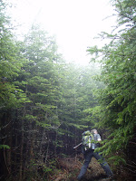
After climbing for a bit the trail leveled off at a muddy section of trail then began to descend gradually along a ridge. I remembered following a ridge for a short way but did not remember descending and especially not this much. Soon I told Scott it just didn't feel right and I think we missed a trail junction or something. It didn't help that I forgot my map and that I couldn't see anything to get my bearings and it was driving me nuts! Scott reassured me that we were most likely on the trail, that I probably just didn't remember this section. And the fact that people we passed earlier were mentioning the fogged in summit. So this had to be the right way!

Continuing along the muddy ridge we finally got a quick glimpse of Moosilauke's summit cone. YAY! The trail began to climb again and once passing through some washed out sections of trail we passed the Benton trail junction and began to pass people coming down who looked wet and wind blown! A couple hikers told us it was very windy up there. We finally broke tree line at 12:30pm and were greeted with a misty wind blowing at a steady 40mph. It was a mild wind and a welcomed refreshment from the muggy lower portions of the mountain. The sky would light up a little now and then, and a tiny patch of blue/clear sky would open briefly giving a short range view. And like a hiker said, "oh look a view, and poof, there it goes!"

Ah well, as 1HappyHiker commented, sometimes the foggy conditions are just as exciting and interesting! And no one was really complaining, most were enjoying the moment. Not even a group of three from Rhode Island and North Carolina where too bothered by no view. They enjoyed the hike up Beaver Brook so much and rather enjoyed the wind and fog! As we approached the true summit, figures began to appear and as usual the summit area was crowded with a dozen or so hikers. Already having this peak we decided to turn back around a have lunch at the tree line where the wind was lighter.

Sitting there for this short time was so nice. Such a calming atmosphere and no pesky bugs to swish away. Actually there had been no bugs at all, all day! That always makes for a great hike! Once we had our fill we headed back down. We met the group of three again along the shoulder of Mt. Blue and we chatted for a bit. They were a very friendly group! We parted ways and made our usual quick descent, slowing as we began the steep and wet hike down along the brook. Below the cabin we began to pass hikers headed up to the cabin. And now the views began to open up a little better!

Along the trail we spotted a couple Northern/Red Spotted Newts which I moved off trail. Back below the cascades and on level ground, ahhhh, we took notice of the wildflowers again and noticed yellow flowers had since come out which were Trout Lily's. So many neat little wildflowers in this moist woods! We finally dragged our weak and tired legs across the last foot bridge and up to the parking lot, finishing at 3:30pm.

Saturday, May 28, 2011

Moose Mountain East Knob 5/26/11

"More Moose!" (pictures)
(Moose Mountains Facebook Group)

Difficulty: Hard (steep/loose/rocky up Burrows Farm Trail)

Directions: From downtown Farmington, NH take Rt. 153 North into Middleton about 5 miles. Continue onto King's Highway for .9 miles. Turn right at the police station onto Ridge Road. At 1.6 miles turn left onto New Portsmouth Road. Bear left onto New Portsmouth Road Exd. The trail head and kiosk will be seen ahead. You can park at the kiosk or continue 400 feet on an unmaintained road to an upper parking area just past the river.

Report: My third day at Moose Mountains Reservation. I wasn't sure just how much time I would spend as a land steward of this mountain range, but there is so much to see here I will never tire of it! Wildflowers, frogs and so much more! We returned to remove the cable I put over the gate the day before. Apparently it can't be locked because it is a class 6 road. So hopefully it can be locked elsewhere to keep the off road vehicles off the fields and hiking trails! Wendy, a Forester with SPNHF will be giving a tour soon and we will be discussing these things.

Anyhow, once this was done we hiked up New Portsmouth Road passing mud pits from the off road truck use which the Green and Northern Leopard Frogs were enjoying. There were dozens of them! Up to the junction with Burrows Farm Trail which is straight ahead. A left here brings you up to the Burrows Farm Site and field and up to Phoebes Nable Mt. Scott destroyed a fire circle here making sure not to leave a single rock, kicking them down the banking. The trail enters a timber landing zone then climbs passing carpets of violets and patches of pink moccasin flowers.

Once passing a "No Motorized Vehicles" sign the trail began a steep, rocky climb up a slippery, rock filled skid road. The heat and humidity was really killing us but didn't slow us down one bit! We passed a ledgy stream then over some ledgy parts of the trail. Soon we were passing by blue berry bushes and more ledge. Snow Mobile trail markers were present up here. The trail levels off and enters a semi-open plateau of Pitch Pine, Red Pine, Blue Berries, rock erratics and ledges. It was a beautiful area!

The breeze was blowing a welcomed coolness and helped keep the black flies at bay. We found deer and moose tracks as well as some fox scat. We also found a 10 gallon plastic pail chained and locked to a tree and wondered what it was there for. We passed through some high brush and came out with a few ticks, one of which was a deer tick, yuck! We did good all day until we hit the tall brush! Getting late, we had to head back down from here to have a quick dinner and head to work. This hike took about 1.5 hours.

Thursday, May 26, 2011

Moose Mountain Reservation 5/25/11

"Tigers and Leopards and Wildflowers Oh, Yah!" (pictures)
(Moose Mountains Facebook Group)

Difficulty: Easy

Directions: From downtown Farmington, NH take Rt. 153 North into Middleton about 5 miles. Continue onto King's Highway for .9 miles. Turn right at the police station onto Ridge Road. At 1.6 miles turn left onto New Portsmouth Road. Bear left onto New Portsmouth Road Exd. The trail head and kiosk will be seen ahead. You can park at the kiosk or continue 400 feet on an unmaintained road to an upper parking area just past the river.


Report: I returned to Moose Mountains Reservation Wednesday to do some work in the access road culverts and to attach a cable to the gate. It was such a beautiful day! I drove my truck up to the point where a stream crosses the road and parked. I did a quick walk up to the Burrows Farm area to make sure no one was up here in a 4x4 or ATV. Such a wonderful spot. Mountains all around, new leaves on trees a bright green, apple trees flowering and blue sky with white wispy clouds. Ahhhh, so lovely!
I then noticed a bug flying ground level across the dirt. It was an Eastern 6 Spotted Tiger Beetle! I love these florescent green beetles! I returned to the main trail heading back and spotted a couple Northern Leopard Frogs. They are so darn quick and blend right in with the ground cover. I did manage to coax one back out of the leaves for a photo op! Wild Flowers caught my attention again as I traveled along. Yellow Downy Violets and Pink Moccasin flowers where the choice today. Surprisingly after having so many ticks on us the day before I did not have a single one today! Must be they come out later in the day. Or because I was staying away from tall grass, mud and trees!

After getting my hiking, photo fix I then got back to my truck and stopped at each culvert to clean the leaves out and get water flowing again. Black flies began to attack as I affixed a cable over the gate and put up "No Wheeled Vehicle" signage. I kind-of felt bad about blocking this 4x4/ATV paradise, not my thing but every one is different and if that's what they like they should be able to have a place to "play"! But it's not allowed, and even if it was, the property is being abused. I can only hope this doesn't end up being a never ending battle! I don't give up easily and this is a beautiful property needing some TLC, so I am in it for the long haul!