

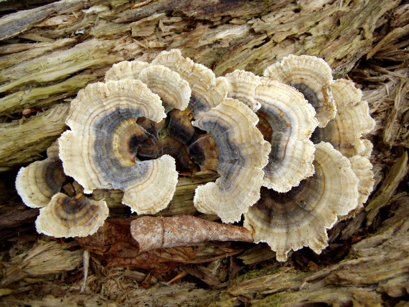


 The day began with the usual drive up Rt.16 with a lot of traffic for 7:00am on a Sunday. The only break of the monotony on this stretch of highway was a turkey making a mad dash across the road, neck stretched out, just barely being missed by a driver who didn't see the bird until the last minute! Turkey's along side the road were plentiful today. Then of course the classic view as you crest over and down a hill section in Wakefield, with an exciting view towards the White's with a quick view of Chocorua close by. We soon broke off 16 and onto Rt. 302 and soon Rt. 113 in Maine. As I have said before, I love 113 as it passes by and through many farm's and farmland. The only difficulty is following the very confusing Road as it makes abrupt turns, especially when heading back in the Southerly direction. We arrived at the Baldface Circle Parking area and to my surprise a half full parking lot. We geared up and headed out at 9:00am sharp. We hiked North up the road and at .1 miles crossed the street to the trailhead. Soon we were passing several groups of people, many with children (coming down) and a man in his late 60's/early 70's who commented on how busy the trail was today. That's OK, we were heading for a less visited peak. We took a picture break at some falls, got viciously barked at by an unleashed dog who scared the heck out of us (thank you to the irresponsible dog owners out there!) and continued on. A man passed us whom we soon caught up with, as he was taking pictures of some attractive funnel mushrooms. I joked, "you beat us to 'em", to which he replied, "don't worry I won't eat them!" We conversed quickly about the shrooms and soon we departed at the junction with Bicknell Ridge TR. Figuring Baldface Circle TR. (South side) and Bicknell Ridge TR were the more popular TR's we kept on Baldface Circle TR (North side). I began to think of how ironic it was, this TR is supposed to be the loop section for the Baldfaces but is little used. Perhaps it should have been called Eagle Crag Trail! This trail begins to climb over rocky terrain and was pretty wet (no surprise that it was wet...seems to be the word of the year!) as it followed the river which contained several flumes, cascades and falls. Once we passed Eagle Cascade Link the trail clearly becomes even less used than the lower section. Overgrowth has overtaken many sections. We took a quick snack stop at this point and continued on our way. Oh, did I mention the mushrooms? They are out in full bloom right now! There were so many varieties. I always "hate" this time of year as we are stopping every 10 ft. to take pics of the shrooms...I love searching for them, keeps you occupied on the trail. I even noticed two wood beatles mating on a tree mushroom...and of course took a pic of them. The forest floor now opens up with large, old trees dotting the landscape. And at about 1900 ft. the trail (which was pretty gradual at this point) began to climb steeply. After some climbing we soon came to rock ledge's and two somewhat tricky rock scrambles. After climbing these with some limited views we broke from the trees and onto the edge of Eagle Crag, a beautiful granite paradise. A short walk and we soon found ourselves on the summit at 12:30pm. Views to the Baldfaces (an exposed granite batholith) was wonderful, to the West was the Carter-Moriah Range (with cloud covered Washington just to the left of the Carters), views North to Evans Notch and Caribou-Speckled Wilderness and finally a crystal clear view East into Maine. We spent a 1/2 hour here without seeing a single soul (except for the tiny specks poking out on top of the baldfaces. We studied our 2 mile long ridge walk to Mt. Meader and headed across on the Meader Ridge TR. The ridge, like most others consists of annoying puds and muddy col's. The only views were after the large middle knoll (which I have named the Eagle's Nest), were a spur path on the West that contains a ledge (which we passed by) and a small ledge on the East. An hour later we found ourselves at the Mt. Meader Trail Junction, passing at some unknown point the true summit. A quick stop with no view and we headed down Mt. Meader TR at 2:00pm. We slowly dropped down some ledges with views to the Baldfaces and to Maine and quickly dropped back into the trees. We passed by four happy ladies (and a LEASHED dog) who exclaimed that we were the first human life forms they had seen today...same with us! We continued on as the trail dropped steeply off the heel of the ridge. This doesn't last to terribly long and the trail becomes pleasant and gradual. Found more shrooms and soon we were on an old logging road following Mill Brook. We came out to Rt.113 once again and made the trek up the road .7 miles back to the parking lot, arriving at 4:00pm. Temps. throughout the day remained in the low to mid 70's under partly to mostly cloudy skies and a light breeze. Black flies present on the ridge and mosquito's along the lower parts of Mt. Meader TR, but were not too bad. This was a beautiful, little traveled loop which I greatly enjoyed! View pics on Flickr> http://www.flickr.com/photos/excape1/sets/72157621750306416/