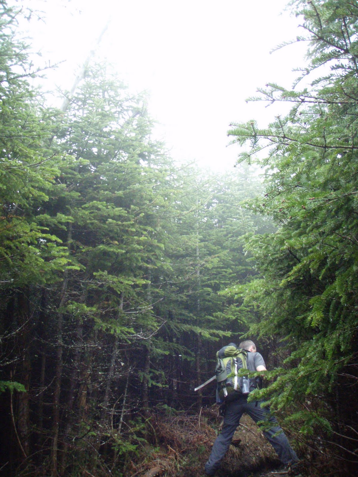
"Fogged in on the Moose!" (pictures)
Difficulty: Very Hard/Expert (wet, slippery, steep trail with ledge climbing and steep drop offs)
Stats (round trip): Mileage> 7.6 - Elevation Gain> 3100' - Book Time> 6:50 hrs - Our Time> 7 hrs.
Directions: From I93 in Lincoln, NH take exit 32. Head West on Rt. 112 continuing straight through intersection for Lost River. After passing lost river at about 6.3 miles the trail head will be on your left on a corner. Signs are present.
Report: With the long Holiday weekend upon us and Saturday looking like it would be a nice day we set our sights on a 4000 footer. I had some peaks in mind and when Scott said "how about Moosilauke?" I quickly agreed! Our last and first summit of 'The Moose' was when we did Beaver Brook Trail in September of 2007, our first year hiking together. And we were anxious to hike this beautiful, steep and rugged part of the Appalachian Trail again! As we arrived in Lincoln the clouds were still hanging onto the peaks and valley's but it looked like it would lift and break by noon.
We parked in an already 1/2 full parking lot, some overnighters no doubt and some day hikers. We started out at 8:30am. The trail along this portion was full of Hobblebush, Bluebead Lily's, Sissile Bellwort, Rose Twisted-stalk and mostly spent Trillium. We signed in at the warning sign reading "This trail is extremely tough. If you lack experience please use another trail. Take special care at the cascades to avoid tragic results." Those types of signs always excite me!
Soon we arrived at Beaver Brook and the 3/4 miles start of nearly continuous cascades! The trail follows the river over steep ledges fitted with steps and re-bar for pulling yourself up. You climb up wet, slippery, broken rock and along side the steep and dangerous brook banking where a slip could be your doom! I could not imagine the campers and through-hikers carrying heavy packs down this trail! It must be so tough!
Still climbing up the steep trail there is plenty of moss and lichen that add to the beauty of this trail. I found some crustose lichen flowering which is not something I had ever seen before. We found a few mushrooms also. Cascades continued, the waters were flowing nicely and it was such a beautiful day. It was getting warm and muggy and it was rather a relief to not have the sun shining down! We stopped and posed for pictures along this exciting trail and amazing world of falling water.
It's one of those areas you could spend all day in taking pictures and taking in the scenery. But just a reminder, extreme caution should be used on this trails and along the bankings which are steep and dangerous. One simple slip and you could be falling down a steep cascade of jagged rock and fast moving water to your death!
Finally we veered away from the brook and passed the trail for the cabin. We started to see people now climbing past us from the cabin and a few descending back to the cabin. Soon we arrived at the Asquam Ridge Trail junction where we straightened out the sign post by wedging in some rocks. From here the trail began to climb rock as it curved around Mt. Blue. There were view spots here and there but the fog was still so thick you could not see beyond a few pine trees.
After climbing for a bit the trail leveled off at a muddy section of trail then began to descend gradually along a ridge. I remembered following a ridge for a short way but did not remember descending and especially not this much. Soon I told Scott it just didn't feel right and I think we missed a trail junction or something. It didn't help that I forgot my map and that I couldn't see anything to get my bearings and it was driving me nuts! Scott reassured me that we were most likely on the trail, that I probably just didn't remember this section. And the fact that people we passed earlier were mentioning the fogged in summit. So this had to be the right way!
Continuing along the muddy ridge we finally got a quick glimpse of Moosilauke's summit cone. YAY! The trail began to climb again and once passing through some washed out sections of trail we passed the Benton trail junction and began to pass people coming down who looked wet and wind blown! A couple hikers told us it was very windy up there. We finally broke tree line at 12:30pm and were greeted with a misty wind blowing at a steady 40mph. It was a mild wind and a welcomed refreshment from the muggy lower portions of the mountain. The sky would light up a little now and then, and a tiny patch of blue/clear sky would open briefly giving a short range view. And like a hiker said, "oh look a view, and poof, there it goes!"
Ah well, as 1HappyHiker commented, sometimes the foggy conditions are just as exciting and interesting! And no one was really complaining, most were enjoying the moment. Not even a group of three from Rhode Island and North Carolina where too bothered by no view. They enjoyed the hike up Beaver Brook so much and rather enjoyed the wind and fog! As we approached the true summit, figures began to appear and as usual the summit area was crowded with a dozen or so hikers. Already having this peak we decided to turn back around a have lunch at the tree line where the wind was lighter.
Sitting there for this short time was so nice. Such a calming atmosphere and no pesky bugs to swish away. Actually there had been no bugs at all, all day! That always makes for a great hike! Once we had our fill we headed back down. We met the group of three again along the shoulder of Mt. Blue and we chatted for a bit. They were a very friendly group! We parted ways and made our usual quick descent, slowing as we began the steep and wet hike down along the brook. Below the cabin we began to pass hikers headed up to the cabin. And now the views began to open up a little better!
Along the trail we spotted a couple Northern/Red Spotted Newts which I moved off trail. Back below the cascades and on level ground, ahhhh, we took notice of the wildflowers again and noticed yellow flowers had since come out which were Trout Lily's. So many neat little wildflowers in this moist woods! We finally dragged our weak and tired legs across the last foot bridge and up to the parking lot, finishing at 3:30pm.
Showing posts with label steep. Show all posts
Monday, May 30, 2011
Sunday, August 22, 2010
Mt. Willey 8/21/10
"Lost half our lunch on Willey!" Pics HERE
Difficulty: Very Hard (Steep, rocky trail/steep ladders)
Stats (Round Trip): Mileage> 5.4 - Elevation Gain> 2985' - Book Time> ?hrs - Our Time> 5hrs.
Directions: Take Rt. 16 through Glen, NH. At the three way intersection continue straight onto Rt. 302N. Follow for approximately 18 miles. Destination will be on your left. There is a pond, and cabins here marked as the Willey House Site. Hiker parking and trail are located at the South end of the buildings (signs)
Report: We had originally planned to hit Adams on Saturday but we felt more like doing a shorter hike. Willey left us hanging (pun intended) this Spring with deep soft snow keeping us from getting beyond Kedron Flume. We began today's hike at the Willey House Site at 7:15am. The trail is very gradual as you pass some boulders and you switchback up to the train tracks. You make a steep climb up the banking on the other side and continue a gradual climb before making a slight drop down to Kedron Flume. The Flume is suffering from various blow downs, one of which was cut up this Spring, but otherwise if you climb up it a little bit you can get a good picture. The limited view to the South end of Webster's slide scarred ridge is also nice.
From here the trail makes an immediate steep climb through a blow down hell, but the heaven sent trail adopter had it all cut and moved aside. This trail section must require a ton of work each year! The steep climb continues until you reach the Ethan Pond trail where it levels off for a bit. In a short distance we kept right onto Willey Range trail. The trail turned steep again, over loose, gravelly sections then becoming very steep. You arrive at the largest collection of ladders I have yet to see in the White's. Not 2, not 4 but I believe there were about 9 ladders most of which were connected. It was awesome!
We got a partial view into the valley below with the river, road and train track snaking through the trees. We continued the very steep climb arriving at a knoll where the trail leveled and trees were smaller. Not the summit yet though! So we continued on becoming steep again before finally arriving into 7 foot high pines, a view point sign and just beyond, at 10:10am we reached the summit cairn at 4285 ft. (no view). We snapped a picture (number 27/48 4000'r for me) and went back to the view spot for lunch.
Views are spectacular with the Presidential range in full view and Mt. Webster "close enough to touch". Views were 180 degrees from just East of Washington all the way around to Carrigain. Some Gray Jays showed up which just made our day all the more wonderful. Out came the sandwiches and these two birds ate half of them! And I got my first Gray Jay pics...sweet! Just as we were packing up a solo hiker with a small dog named pepper showed up and chatted with us. He was doing a Field/Willey/Webster loop.
We parted and began the steep decent back the way we came. We passed a dozen people coming up, and we were glad to see we weren't the only ones astounded by how steep the trail was. And how awesome, but "calf killing" the ladders were. Many asked how much further there was to go. Not something I like being asked (and I never ask) and I usually say I don't know, but today, with such a steep trail I tried to comfort them with a reasonable estimate. One English couple in particular had us laughing. Husband to wife trying to catch up on a steep section (with English accent): Husband: "Come on you Bimbo!". Wife: "I'm coming, why did they have to put this retched rock in the way"!
Pics HERE
Difficulty: Very Hard (Steep, rocky trail/steep ladders)
Stats (Round Trip): Mileage> 5.4 - Elevation Gain> 2985' - Book Time> ?hrs - Our Time> 5hrs.
Directions: Take Rt. 16 through Glen, NH. At the three way intersection continue straight onto Rt. 302N. Follow for approximately 18 miles. Destination will be on your left. There is a pond, and cabins here marked as the Willey House Site. Hiker parking and trail are located at the South end of the buildings (signs)
Report: We had originally planned to hit Adams on Saturday but we felt more like doing a shorter hike. Willey left us hanging (pun intended) this Spring with deep soft snow keeping us from getting beyond Kedron Flume. We began today's hike at the Willey House Site at 7:15am. The trail is very gradual as you pass some boulders and you switchback up to the train tracks. You make a steep climb up the banking on the other side and continue a gradual climb before making a slight drop down to Kedron Flume. The Flume is suffering from various blow downs, one of which was cut up this Spring, but otherwise if you climb up it a little bit you can get a good picture. The limited view to the South end of Webster's slide scarred ridge is also nice.
From here the trail makes an immediate steep climb through a blow down hell, but the heaven sent trail adopter had it all cut and moved aside. This trail section must require a ton of work each year! The steep climb continues until you reach the Ethan Pond trail where it levels off for a bit. In a short distance we kept right onto Willey Range trail. The trail turned steep again, over loose, gravelly sections then becoming very steep. You arrive at the largest collection of ladders I have yet to see in the White's. Not 2, not 4 but I believe there were about 9 ladders most of which were connected. It was awesome!
We got a partial view into the valley below with the river, road and train track snaking through the trees. We continued the very steep climb arriving at a knoll where the trail leveled and trees were smaller. Not the summit yet though! So we continued on becoming steep again before finally arriving into 7 foot high pines, a view point sign and just beyond, at 10:10am we reached the summit cairn at 4285 ft. (no view). We snapped a picture (number 27/48 4000'r for me) and went back to the view spot for lunch.
We parted and began the steep decent back the way we came. We passed a dozen people coming up, and we were glad to see we weren't the only ones astounded by how steep the trail was. And how awesome, but "calf killing" the ladders were. Many asked how much further there was to go. Not something I like being asked (and I never ask) and I usually say I don't know, but today, with such a steep trail I tried to comfort them with a reasonable estimate. One English couple in particular had us laughing. Husband to wife trying to catch up on a steep section (with English accent): Husband: "Come on you Bimbo!". Wife: "I'm coming, why did they have to put this retched rock in the way"!
We descended pretty quickly, especially once we were back on Kedron Flume trail where things leveled out. We were passed by the man and dog we met earlier headed to Webster. We arrived back at the lot, full of tourists. Time was 12:15pm.
Pics HERE
Labels:
"mt. willey",
"white mountains",
4000 footers,
ladders,
ledge,
steep
Monday, August 2, 2010
Great Gulf (Mt. Washington) 7/31/10
View the pics HERE
The Great Gulf, Great in every sense of the word!We had this trip planned all week and the weather forecast for Saturday stayed looking perfect! We arrived at the Wilderness parking lot and headed down the trail bright and early at 7:15am. We planned for a 12 hour hike so we weren't wasting anytime. A man coming down said hi as he passed then blurted out, "you're entering bear country!" Yikes, you don't say!? That's OK, we came prepared, I threw a can of hornet spray in my pack for just such an unfortunate occasion. Pictures were kept to a minimum, well, for the most part! Mushrooms were numerous and the Gulf trail follows the river most of the way, and it is very difficult not to be stopping to view the continuous cascades.
The trail makes some moderate climbs and finally comes to Spaulding Lake (4228'), which we reached at 12:00pm (exactly at book time of 4:45). Rather unique in it's own way, but really not much to look at we carried on looking for a rock with a view to eat lunch. Unfortunately there was no such spot until we got a little ways up the head wall. We finally got to inhale our lunch and take a breather. The Head wall wasn't as climatic as the other ravines and it really didn't look all that difficult.
Well, I ate those words. The climb up the head wall was very steep as it climbs up the small stream of rock and moss. Numerous flowers were blooming which made for some gorgeous scenery. Oh, and can't forget about the view down the gulf and up to the Northern Presidential's! It was neat to see how the gulf floor drops quite steeply just under the lake. From the top of the head wall the gulf floor looks level. We very carefully crawled our way up, a bad step on this climb could result in a very painful fall, or worse! Near the top of the head wall we past a few guys making there way down and an older man whom we chatted with briefly. He stated he was heading to the parking lot, and we would probably beat him there. It's funny, everyone including him were shocked to see us ascending the wall. Personally I would rather climb it, it's very steep and slippery and not something I would want to try and climb down!
A cheer from Scott meant we had reached the top of the head wall and our first view of Washington summit was ahead. So close to not keep going to the peak Scott once again took off! We stopped a couple times to answer trail questions (never fails on the Presi's!) and finally reached the observation deck at 2:15pm. Scott's third year of hiking, several attempts at summiting Washington and we finally made it. I hadn't been up to the summit in exactly 4 years! (7/30/10) What a coincidence!! The crowded summit sign was crazy, no surprise on a day like today. So we skipped standing in line amongst the chaos for a pic and just chilled and snacked a bit on the deck. We quickly had our fill of the noise and such and headed down the Nelson trail, over Ball Crag and on to the Wamsutta trail.
Wamsutta was Weetamoo's 1st of 6 husbands and man, he must have been a gentle person but with a fierce side! The trail starts off on the Auto Roads winter route then quickly breaks off headed down a partially open ridge visible ahead. The trail is gentle with soft dirt and pine needles underfoot. A few rocks to negotiate here and there, made difficult by the overgrown alpines blocking your view of whats under your feet and a small stream that the trail follows briefly. We were commenting on how lovely and comfortable the trail was, but I was pretty certain that would change once over the bluff. We reached the bluff with a unique view of Jefferson's knees right in front of you and views up to the Great Gulf head wall. Then the fun started!
Now the trail drop, drop, dropped! I think it is something like 1000 ft. in less than a mile! Ledge scramble after ledge scramble our tiring body's being pushed to there limits! Of all the hikes I have done, and of all the Great Gulf trails I've taken, this trail I believe is the steepest and most technical I've yet to see. It was awesome! Once below the ledges the trail once again levels off with comfortable footing. Happy to see the Great Gulf junction we started the long hike back down. Just below the bluff area we caught up with the man we chatted with on the head wall! We laughed and joked, this guy was pretty humorous. I poked a little fun with him, "You said we'd beat you! Just barely though!" We came to the climb up to the bluff, and he joked, "why do they have to put an uphill when your trying to go downhill!" He called us his heroes for tackling such a long and difficult loop, which made us feel pretty good, it's not often we take on such a huge trip and we felt we had done really good.
Down further near the Osgood junction two guys were standing next to the trail, one with a clipboard dressed like Curious George. I was caught off guard when the other guy said as we passed, "Jason?" Turned out to be Rich (lal12) from Hike-NH headed out from a Six Husbands-Northern Presi-Osgood loop. He caught up to us a little further down and we chatted about our day. Then we said our farewells and he bolted down the trail, a 3 hour drive ahead of him! Nice to meet you Rich! We trudged along what seems like such a long section of trail when your tired and finally crossed the bridge and arrived back at the parking lot at 6:30pm.
A beautiful day! Spectacular, wild and steep trails. Perfect temps. An overcast sky and hardly a bug! We couldn't have asked for better :) 14.8 miles, about 5300 ft. elevation gain, 11.5 hours.
View the pics HERE
The Great Gulf, Great in every sense of the word!We had this trip planned all week and the weather forecast for Saturday stayed looking perfect! We arrived at the Wilderness parking lot and headed down the trail bright and early at 7:15am. We planned for a 12 hour hike so we weren't wasting anytime. A man coming down said hi as he passed then blurted out, "you're entering bear country!" Yikes, you don't say!? That's OK, we came prepared, I threw a can of hornet spray in my pack for just such an unfortunate occasion. Pictures were kept to a minimum, well, for the most part! Mushrooms were numerous and the Gulf trail follows the river most of the way, and it is very difficult not to be stopping to view the continuous cascades.Scott was burning up the trail today. I have never seen him take the lead with such speed. Perhaps it was the thought of the climb ahead. Fast forward >> we passed the Six Husbands trail and finally made it to the Sphinx trail junction. Here on up would be new territory for us. The trail immediately got narrower and less traveled. The cascades and waterfalls in this area are spectacular! We got a little confused at a small river crossing, finally seeing a small cairn upstream slightly that went up into an inlet brook. The trail crossed this stream various times, plan to get your boots wet if you take this trail! Luckily the waterproofing spray was working perfectly!
The trail makes some moderate climbs and finally comes to Spaulding Lake (4228'), which we reached at 12:00pm (exactly at book time of 4:45). Rather unique in it's own way, but really not much to look at we carried on looking for a rock with a view to eat lunch. Unfortunately there was no such spot until we got a little ways up the head wall. We finally got to inhale our lunch and take a breather. The Head wall wasn't as climatic as the other ravines and it really didn't look all that difficult.
Wamsutta was Weetamoo's 1st of 6 husbands and man, he must have been a gentle person but with a fierce side! The trail starts off on the Auto Roads winter route then quickly breaks off headed down a partially open ridge visible ahead. The trail is gentle with soft dirt and pine needles underfoot. A few rocks to negotiate here and there, made difficult by the overgrown alpines blocking your view of whats under your feet and a small stream that the trail follows briefly. We were commenting on how lovely and comfortable the trail was, but I was pretty certain that would change once over the bluff. We reached the bluff with a unique view of Jefferson's knees right in front of you and views up to the Great Gulf head wall. Then the fun started!
Now the trail drop, drop, dropped! I think it is something like 1000 ft. in less than a mile! Ledge scramble after ledge scramble our tiring body's being pushed to there limits! Of all the hikes I have done, and of all the Great Gulf trails I've taken, this trail I believe is the steepest and most technical I've yet to see. It was awesome! Once below the ledges the trail once again levels off with comfortable footing. Happy to see the Great Gulf junction we started the long hike back down. Just below the bluff area we caught up with the man we chatted with on the head wall! We laughed and joked, this guy was pretty humorous. I poked a little fun with him, "You said we'd beat you! Just barely though!" We came to the climb up to the bluff, and he joked, "why do they have to put an uphill when your trying to go downhill!" He called us his heroes for tackling such a long and difficult loop, which made us feel pretty good, it's not often we take on such a huge trip and we felt we had done really good.
Down further near the Osgood junction two guys were standing next to the trail, one with a clipboard dressed like Curious George. I was caught off guard when the other guy said as we passed, "Jason?" Turned out to be Rich (lal12) from Hike-NH headed out from a Six Husbands-Northern Presi-Osgood loop. He caught up to us a little further down and we chatted about our day. Then we said our farewells and he bolted down the trail, a 3 hour drive ahead of him! Nice to meet you Rich! We trudged along what seems like such a long section of trail when your tired and finally crossed the bridge and arrived back at the parking lot at 6:30pm.
A beautiful day! Spectacular, wild and steep trails. Perfect temps. An overcast sky and hardly a bug! We couldn't have asked for better :) 14.8 miles, about 5300 ft. elevation gain, 11.5 hours.
View the pics HERE
Subscribe to:
Posts (Atom)